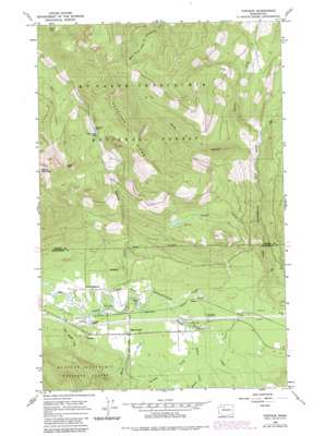
Fortson Topo Map Washington
To zoom in, hover over the map of Fortson
USGS Topo Quad 48121c6 - 1:24,000 scale
| Topo Map Name: | Fortson |
| USGS Topo Quad ID: | 48121c6 |
| Print Size: | ca. 21 1/4" wide x 27" high |
| Southeast Coordinates: | 48.25° N latitude / 121.625° W longitude |
| Map Center Coordinates: | 48.3125° N latitude / 121.6875° W longitude |
| U.S. State: | WA |
| Filename: | o48121c6.jpg |
| Download Map JPG Image: | Fortson topo map 1:24,000 scale |
| Map Type: | Topographic |
| Topo Series: | 7.5´ |
| Map Scale: | 1:24,000 |
| Source of Map Images: | United States Geological Survey (USGS) |
| Alternate Map Versions: |
Fortson WA 1966, updated 1968 Download PDF Buy paper map Fortson WA 1966, updated 1977 Download PDF Buy paper map Fortson WA 1966, updated 1982 Download PDF Buy paper map Fortson WA 2011 Download PDF Buy paper map Fortson WA 2014 Download PDF Buy paper map |
| FStopo: | US Forest Service topo Fortson is available: Download FStopo PDF Download FStopo TIF |
1:24,000 Topo Quads surrounding Fortson
> Back to 48121a1 at 1:100,000 scale
> Back to 48120a1 at 1:250,000 scale
> Back to U.S. Topo Maps home
Fortson topo map: Gazetteer
Fortson: Dams
Fortson Mill Pond Dam elevation 118m 387′Fortson: Gaps
Coney Pass elevation 1215m 3986′Deer Creek Pass elevation 1044m 3425′
Fortson: Lakes
Fortson Ponds elevation 120m 393′Harry Lake elevation 1130m 3707′
Segelsen Lake elevation 1045m 3428′
Fortson: Parks
Squire Creek Park elevation 143m 469′Fortson: Populated Places
Barco elevation 144m 472′Fortson elevation 144m 472′
Swede Heaven elevation 125m 410′
White Horse elevation 141m 462′
Fortson: Reservoirs
Fortson Mill Pond elevation 118m 387′Fortson: Ridges
Segelsen Ridge elevation 1283m 4209′Fortson: Streams
Ashton Creek elevation 136m 446′Cascade Creek elevation 256m 839′
Crevice Creek elevation 279m 915′
Furland Creek elevation 136m 446′
Little French Creek elevation 111m 364′
Moose Creek elevation 128m 419′
Segelsen Creek elevation 118m 387′
South Branch North Fork Stillaguamish River elevation 269m 882′
Squire Creek elevation 130m 426′
Fortson: Valleys
Snow Gulch elevation 169m 554′Fortson digital topo map on disk
Buy this Fortson topo map showing relief, roads, GPS coordinates and other geographical features, as a high-resolution digital map file on DVD:


