Bacon Peak Topo Map Washington
To zoom in, hover over the map of Bacon Peak
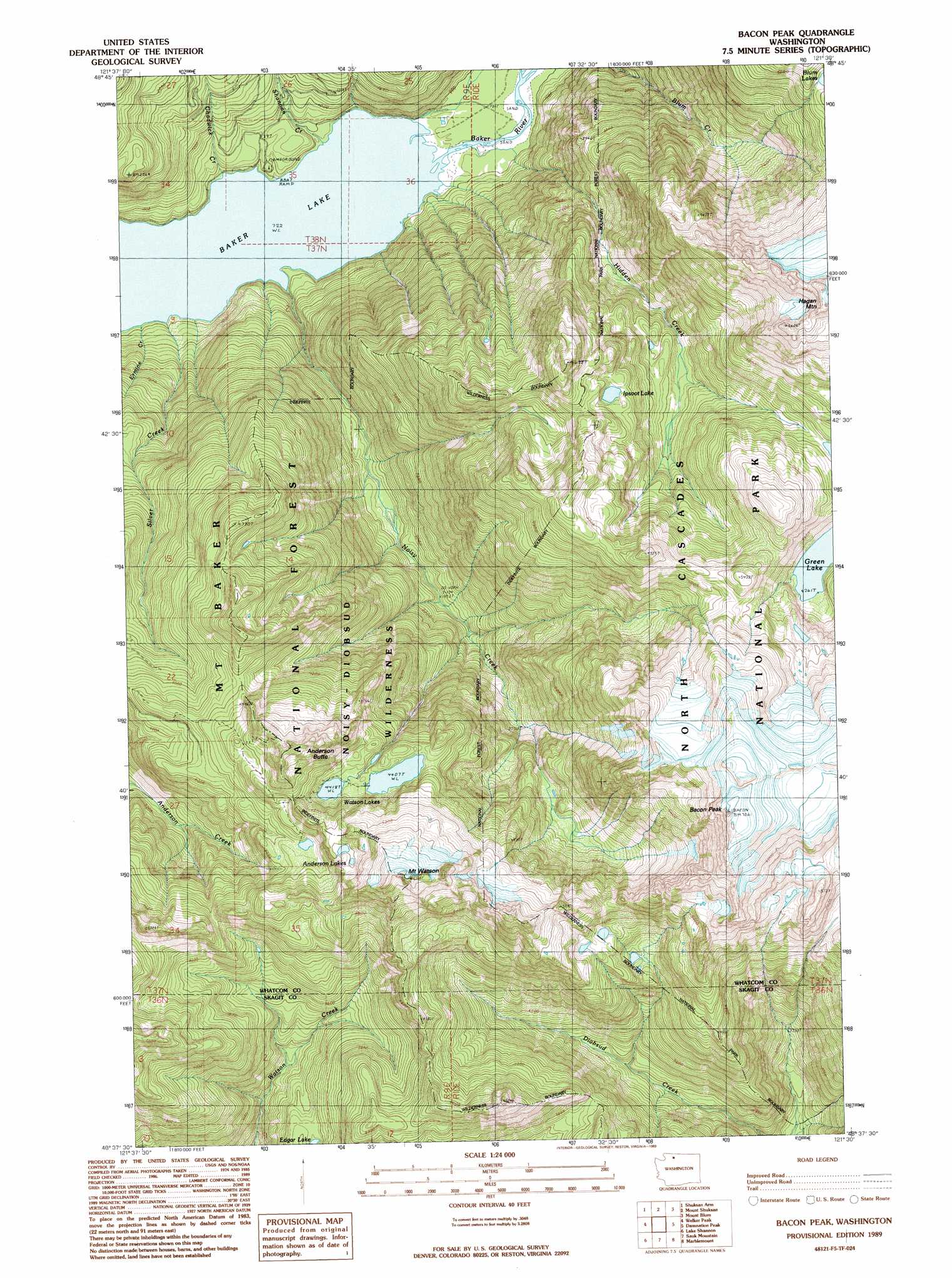
USGS Topo Quad 48121f5 - 1:24,000 scale
| Topo Map Name: | Bacon Peak |
| USGS Topo Quad ID: | 48121f5 |
| Print Size: | ca. 21 1/4" wide x 27" high |
| Southeast Coordinates: | 48.625° N latitude / 121.5° W longitude |
| Map Center Coordinates: | 48.6875° N latitude / 121.5625° W longitude |
| U.S. State: | WA |
| Filename: | o48121f5.jpg |
| Download Map JPG Image: | Bacon Peak topo map 1:24,000 scale |
| Map Type: | Topographic |
| Topo Series: | 7.5´ |
| Map Scale: | 1:24,000 |
| Source of Map Images: | United States Geological Survey (USGS) |
| Alternate Map Versions: |
Bacon Peak WA 1989, updated 1989 Download PDF Buy paper map Bacon Peak WA 1989, updated 1989 Download PDF Buy paper map Bacon Peak WA 1999, updated 2002 Download PDF Buy paper map Bacon Peak WA 2011 Download PDF Buy paper map Bacon Peak WA 2014 Download PDF Buy paper map |
| FStopo: | US Forest Service topo Bacon Peak is available: Download FStopo PDF Download FStopo TIF |
1:24,000 Topo Quads surrounding Bacon Peak
Bearpaw Mountain |
Mount Larrabee |
Mount Sefrit |
Copper Mountain |
Mount Redoubt |
Mount Baker |
Shuksan Arm |
Mount Shuksan |
Mount Blum |
Mount Challenger |
Baker Pass |
Welker Peak |
Bacon Peak |
Damnation Peak |
Mount Triumph |
Grandy Lake |
Lake Shannon |
Sauk Mountain |
Marblemount |
Big Devil Peak |
Gee Point |
Finney Peak |
Rockport |
Illabot Peaks |
Snowking Mountain |
> Back to 48121e1 at 1:100,000 scale
> Back to 48120a1 at 1:250,000 scale
> Back to U.S. Topo Maps home
Bacon Peak topo map: Gazetteer
Bacon Peak: Lakes
Anderson Lakes elevation 1526m 5006′Green Lake elevation 1300m 4265′
Ipsoot Lake elevation 1364m 4475′
Watson Lakes elevation 1357m 4452′
Bacon Peak: Streams
Chadwick Creek elevation 221m 725′Ermine Creek elevation 221m 725′
Hidden Creek elevation 233m 764′
Noisy Creek elevation 221m 725′
Shannon Creek elevation 221m 725′
Silver Creek elevation 221m 725′
Bacon Peak: Summits
Anderson Butte elevation 1705m 5593′Bacon Peak elevation 2138m 7014′
Hagan Mountain elevation 2060m 6758′
Mount Watson elevation 1822m 5977′
Bacon Peak digital topo map on disk
Buy this Bacon Peak topo map showing relief, roads, GPS coordinates and other geographical features, as a high-resolution digital map file on DVD: