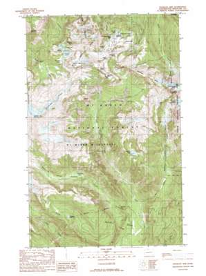
Shuksan Arm Topo Map Washington
To zoom in, hover over the map of Shuksan Arm
USGS Topo Quad 48121g6 - 1:24,000 scale
| Topo Map Name: | Shuksan Arm |
| USGS Topo Quad ID: | 48121g6 |
| Print Size: | ca. 21 1/4" wide x 27" high |
| Southeast Coordinates: | 48.75° N latitude / 121.625° W longitude |
| Map Center Coordinates: | 48.8125° N latitude / 121.6875° W longitude |
| U.S. State: | WA |
| Filename: | o48121g6.jpg |
| Download Map JPG Image: | Shuksan Arm topo map 1:24,000 scale |
| Map Type: | Topographic |
| Topo Series: | 7.5´ |
| Map Scale: | 1:24,000 |
| Source of Map Images: | United States Geological Survey (USGS) |
| Alternate Map Versions: |
Shuksan Arm WA 1989, updated 1989 Download PDF Buy paper map Shuksan Arm WA 1989, updated 1989 Download PDF Buy paper map Shuksan Arm WA 2011 Download PDF Buy paper map Shuksan Arm WA 2014 Download PDF Buy paper map |
| FStopo: | US Forest Service topo Shuksan Arm is available: Download FStopo PDF Download FStopo TIF |
1:24,000 Topo Quads surrounding Shuksan Arm
> Back to 48121e1 at 1:100,000 scale
> Back to 48120a1 at 1:250,000 scale
> Back to U.S. Topo Maps home
Shuksan Arm topo map: Gazetteer
Shuksan Arm: Bays
Shuksan Arm elevation 1678m 5505′Shuksan Arm: Cliffs
Huntoon Point elevation 1588m 5209′Shuksan Arm: Falls
Mazama Falls elevation 1190m 3904′Rainbow Falls elevation 519m 1702′
Shuksan Arm: Flats
Heather Meadows elevation 1293m 4242′Shuksan Arm: Gaps
Austin Pass elevation 1411m 4629′Shuksan Arm: Glaciers
Table Mountain Glacier elevation 1692m 5551′Shuksan Arm: Lakes
Arbuthnet Lake elevation 1454m 4770′Austin Pass Lake elevation 1327m 4353′
Bagley Lakes elevation 1281m 4202′
Galena Chain Lakes elevation 1478m 4849′
Hayes Lake elevation 1458m 4783′
Highwood Lake elevation 1257m 4124′
Iceberg Lake elevation 1462m 4796′
Lake Ann elevation 1439m 4721′
Maiden Lake elevation 1196m 3923′
Marten Lake elevation 1107m 3631′
Mazama Lake elevation 1435m 4708′
Mount Baker Lodge Lakes elevation 1255m 4117′
Picture Lake elevation 1260m 4133′
Rainbow Lake elevation 890m 2919′
Sunrise Lake elevation 1292m 4238′
Terminal Lake elevation 1336m 4383′
Shuksan Arm: Pillars
Coleman Pinnacle elevation 1903m 6243′Fisher Chimney elevation 2000m 6561′
Shuksan Arm: Post Offices
Mount Baker Post Office (historical) elevation 1294m 4245′Shuksan Arm: Ridges
Kulshan Ridge elevation 1504m 4934′Lava Divide elevation 1236m 4055′
Ptarmigan Ridge elevation 1625m 5331′
Shuksan Arm: Springs
Baker Hot Spring elevation 449m 1473′Shuksan Arm: Streams
Rainbow Creek elevation 366m 1200′Shuksan Creek elevation 375m 1230′
Shuksan Arm: Summits
Barometer Mountain elevation 1757m 5764′Mazama Dome elevation 1767m 5797′
Mount Hermann elevation 1891m 6204′
Panorama Dome elevation 1530m 5019′
Table Mountain elevation 1748m 5734′
Shuksan Arm: Valleys
Avalanche Gorge elevation 795m 2608′Shuksan Arm digital topo map on disk
Buy this Shuksan Arm topo map showing relief, roads, GPS coordinates and other geographical features, as a high-resolution digital map file on DVD:


