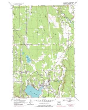
Lake Stevens Topo Map Washington
To zoom in, hover over the map of Lake Stevens
USGS Topo Quad 48122a1 - 1:24,000 scale
| Topo Map Name: | Lake Stevens |
| USGS Topo Quad ID: | 48122a1 |
| Print Size: | ca. 21 1/4" wide x 27" high |
| Southeast Coordinates: | 48° N latitude / 122° W longitude |
| Map Center Coordinates: | 48.0625° N latitude / 122.0625° W longitude |
| U.S. State: | WA |
| Filename: | o48122a1.jpg |
| Download Map JPG Image: | Lake Stevens topo map 1:24,000 scale |
| Map Type: | Topographic |
| Topo Series: | 7.5´ |
| Map Scale: | 1:24,000 |
| Source of Map Images: | United States Geological Survey (USGS) |
| Alternate Map Versions: |
Lake Stevens WA 1956, updated 1957 Download PDF Buy paper map Lake Stevens WA 1956, updated 1968 Download PDF Buy paper map Lake Stevens WA 1956, updated 1969 Download PDF Buy paper map Lake Stevens WA 1956, updated 1990 Download PDF Buy paper map Lake Stevens WA 1956, updated 1990 Download PDF Buy paper map Lake Stevens WA 2011 Download PDF Buy paper map Lake Stevens WA 2014 Download PDF Buy paper map |
1:24,000 Topo Quads surrounding Lake Stevens
> Back to 48122a1 at 1:100,000 scale
> Back to 48122a1 at 1:250,000 scale
> Back to U.S. Topo Maps home
Lake Stevens topo map: Gazetteer
Lake Stevens: Airports
Ed Large Field elevation 99m 324′Frontier Airpark elevation 146m 479′
Green Valley Air Field elevation 95m 311′
Lake Stevens: Dams
Rainbow Springs Dam elevation 59m 193′Woodland Farm Reservoir Dam elevation 74m 242′
Lake Stevens: Lakes
Connor Lake elevation 59m 193′Lake Cassidy elevation 98m 321′
Lake Stevens elevation 65m 213′
Martha Lake elevation 100m 328′
Lake Stevens: Populated Places
Getchell elevation 113m 370′Hartford elevation 69m 226′
Hyland elevation 77m 252′
Lake Stevens elevation 66m 216′
Lochsloy elevation 72m 236′
Riverside elevation 92m 301′
Sisco Heights elevation 139m 456′
Sobey elevation 80m 262′
Lake Stevens: Reservoirs
Woodland Farm Reservoir elevation 74m 242′Lake Stevens: Streams
Catherine Creek elevation 53m 173′Star Creek elevation 91m 298′
Lake Stevens: Summits
Getchell Hill elevation 130m 426′Lake Stevens digital topo map on disk
Buy this Lake Stevens topo map showing relief, roads, GPS coordinates and other geographical features, as a high-resolution digital map file on DVD:


