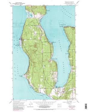
Freeland Topo Map Washington
To zoom in, hover over the map of Freeland
USGS Topo Quad 48122a5 - 1:24,000 scale
| Topo Map Name: | Freeland |
| USGS Topo Quad ID: | 48122a5 |
| Print Size: | ca. 21 1/4" wide x 27" high |
| Southeast Coordinates: | 48° N latitude / 122.5° W longitude |
| Map Center Coordinates: | 48.0625° N latitude / 122.5625° W longitude |
| U.S. State: | WA |
| Filename: | o48122a5.jpg |
| Download Map JPG Image: | Freeland topo map 1:24,000 scale |
| Map Type: | Topographic |
| Topo Series: | 7.5´ |
| Map Scale: | 1:24,000 |
| Source of Map Images: | United States Geological Survey (USGS) |
| Alternate Map Versions: |
Freeland WA 1953, updated 1955 Download PDF Buy paper map Freeland WA 1953, updated 1963 Download PDF Buy paper map Freeland WA 1953, updated 1969 Download PDF Buy paper map Freeland WA 1953, updated 1984 Download PDF Buy paper map Freeland WA 1953, updated 1990 Download PDF Buy paper map Freeland WA 1953, updated 1990 Download PDF Buy paper map Freeland WA 1998, updated 2003 Download PDF Buy paper map Freeland WA 2011 Download PDF Buy paper map Freeland WA 2014 Download PDF Buy paper map |
1:24,000 Topo Quads surrounding Freeland
> Back to 48122a1 at 1:100,000 scale
> Back to 48122a1 at 1:250,000 scale
> Back to U.S. Topo Maps home
Freeland topo map: Gazetteer
Freeland: Bays
Holmes Harbor elevation 0m 0′Honeymoon Bay elevation 0m 0′
Freeland: Capes
Bush Point elevation 2m 6′Dines Point elevation 2m 6′
Lagoon Point elevation 2m 6′
Rocky Point elevation 8m 26′
Freeland: Cliffs
Pratts Bluff elevation 0m 0′Freeland: Dams
Honeymoon Lake Dam elevation 9m 29′Freeland: Islands
Baby Island elevation 2m 6′Freeland: Lakes
Chase Lake elevation 60m 196′Lake Hancock elevation 2m 6′
Freeland: Parks
South Whidbey Island State Park elevation 31m 101′Freeland: Populated Places
Baby Island Heights elevation 20m 65′Beverly Beach elevation 16m 52′
Freeland elevation 33m 108′
Greenbank elevation 48m 157′
Harbor Center elevation 34m 111′
Freeland: Reservoirs
Honeymoon Lake elevation 9m 29′Freeland digital topo map on disk
Buy this Freeland topo map showing relief, roads, GPS coordinates and other geographical features, as a high-resolution digital map file on DVD:


