Arlington East Topo Map Washington
To zoom in, hover over the map of Arlington East
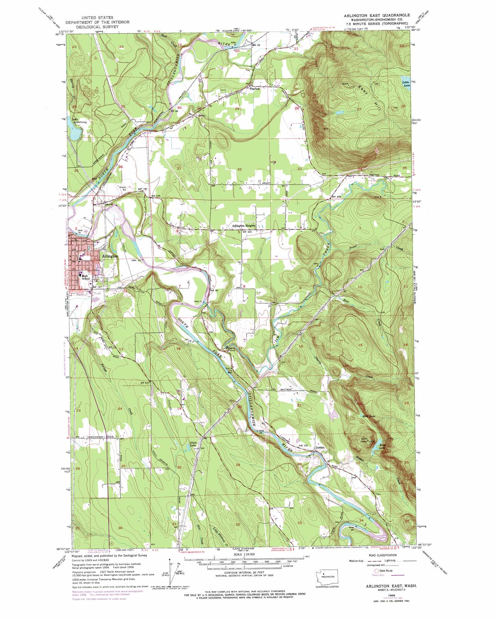
USGS Topo Quad 48122b1 - 1:24,000 scale
| Topo Map Name: | Arlington East |
| USGS Topo Quad ID: | 48122b1 |
| Print Size: | ca. 21 1/4" wide x 27" high |
| Southeast Coordinates: | 48.125° N latitude / 122° W longitude |
| Map Center Coordinates: | 48.1875° N latitude / 122.0625° W longitude |
| U.S. State: | WA |
| Filename: | o48122b1.jpg |
| Download Map JPG Image: | Arlington East topo map 1:24,000 scale |
| Map Type: | Topographic |
| Topo Series: | 7.5´ |
| Map Scale: | 1:24,000 |
| Source of Map Images: | United States Geological Survey (USGS) |
| Alternate Map Versions: |
Arlington East WA 1956, updated 1957 Download PDF Buy paper map Arlington East WA 1956, updated 1966 Download PDF Buy paper map Arlington East WA 1956, updated 1969 Download PDF Buy paper map Arlington East WA 1956, updated 1977 Download PDF Buy paper map Arlington East WA 2011 Download PDF Buy paper map Arlington East WA 2014 Download PDF Buy paper map |
1:24,000 Topo Quads surrounding Arlington East
Mount Vernon |
Sedro-Woolley South |
Haystack Mountain |
Day Lake |
Gee Point |
Conway |
Mcmurray |
Stimson Hill |
Oso |
Mount Higgins |
Stanwood |
Arlington West |
Arlington East |
Riley Lake |
Meadow Mountain |
Tulalip |
Marysville |
Lake Stevens |
Granite Falls |
Verlot |
Mukilteo |
Everett |
Snohomish |
Lake Roesiger |
Lake Chaplain |
> Back to 48122a1 at 1:100,000 scale
> Back to 48122a1 at 1:250,000 scale
> Back to U.S. Topo Maps home
Arlington East topo map: Gazetteer
Arlington East: Airports
Canady Landing Area elevation 63m 206′Arlington East: Dams
Canaday Dam elevation 466m 1528′Evancha Dam Number Two elevation 154m 505′
Evanchaa Dam Number One elevation 150m 492′
Arlington East: Lakes
King Lake elevation 142m 465′Lake Armstrong elevation 42m 137′
Little Lake elevation 463m 1519′
Mud Lake elevation 150m 492′
Olson Lake elevation 153m 501′
Arlington East: Parks
East Arlington Regional Park elevation 29m 95′Twin Rivers Park elevation 20m 65′
Arlington East: Populated Places
Arlington Heights elevation 94m 308′Jordan elevation 52m 170′
Trafton elevation 62m 203′
Arlington East: Streams
Bear Creek elevation 68m 223′Eagle Creek elevation 19m 62′
Jim Creek elevation 28m 91′
Jordan Creek elevation 47m 154′
Porter Creek elevation 66m 216′
Rock Creek elevation 23m 75′
Siberia Creek elevation 48m 157′
Arlington East: Summits
Ebey Hill elevation 539m 1768′Arlington East digital topo map on disk
Buy this Arlington East topo map showing relief, roads, GPS coordinates and other geographical features, as a high-resolution digital map file on DVD: