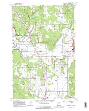
Arlington West Topo Map Washington
To zoom in, hover over the map of Arlington West
USGS Topo Quad 48122b2 - 1:24,000 scale
| Topo Map Name: | Arlington West |
| USGS Topo Quad ID: | 48122b2 |
| Print Size: | ca. 21 1/4" wide x 27" high |
| Southeast Coordinates: | 48.125° N latitude / 122.125° W longitude |
| Map Center Coordinates: | 48.1875° N latitude / 122.1875° W longitude |
| U.S. State: | WA |
| Filename: | o48122b2.jpg |
| Download Map JPG Image: | Arlington West topo map 1:24,000 scale |
| Map Type: | Topographic |
| Topo Series: | 7.5´ |
| Map Scale: | 1:24,000 |
| Source of Map Images: | United States Geological Survey (USGS) |
| Alternate Map Versions: |
Arlington West WA 1956, updated 1957 Download PDF Buy paper map Arlington West WA 1956, updated 1966 Download PDF Buy paper map Arlington West WA 1956, updated 1969 Download PDF Buy paper map Arlington West WA 1956, updated 1976 Download PDF Buy paper map Arlington West WA 1956, updated 1982 Download PDF Buy paper map Arlington West WA 1956, updated 1995 Download PDF Buy paper map Arlington West WA 2011 Download PDF Buy paper map Arlington West WA 2014 Download PDF Buy paper map |
1:24,000 Topo Quads surrounding Arlington West
> Back to 48122a1 at 1:100,000 scale
> Back to 48122a1 at 1:250,000 scale
> Back to U.S. Topo Maps home
Arlington West topo map: Gazetteer
Arlington West: Airports
Arlington Municipal Airport elevation 40m 131′Arlington West: Crossings
Interchange 206 elevation 38m 124′Interchange 208 elevation 13m 42′
Lake Goodwin Road Interchange elevation 38m 124′
State Route 530 Interchange elevation 13m 42′
Arlington West: Dams
Edward Springs Reservoir Dam elevation 69m 226′Quilceda Creek Dam elevation 51m 167′
Quilceda Trout Farm Dam elevation 62m 203′
Rio Mount Dam elevation 34m 111′
Arlington West: Flats
The Island elevation 13m 42′Arlington West: Lakes
Bryant Lake elevation 46m 150′Arlington West: Parks
Arlington Airport Park elevation 42m 137′Blue Stilly Park elevation 10m 32′
Haller Bridge Park elevation 19m 62′
Arlington West: Populated Places
Arlington elevation 35m 114′Arlington Junction elevation 19m 62′
Bryant elevation 52m 170′
Edgecomb elevation 42m 137′
English elevation 38m 124′
Lakewood elevation 37m 121′
Sisco elevation 46m 150′
Smokey Point elevation 38m 124′
Totem Park elevation 39m 127′
Arlington West: Reservoirs
Edward Springs Reservoir elevation 69m 226′Quilceda Creek Reservoir elevation 51m 167′
Arlington West: Streams
Armstrong Creek elevation 14m 45′Cook Slough elevation 5m 16′
Cougar Creek elevation 35m 114′
Harvey Creek elevation 42m 137′
March Creek elevation 18m 59′
North Fork Stillaguamish River elevation 14m 45′
Pilchuck Creek elevation 8m 26′
Portage Creek elevation 5m 16′
South Fork Stillaguamish River elevation 15m 49′
Arlington West: Valleys
Jackson Gulch elevation 12m 39′Arlington West digital topo map on disk
Buy this Arlington West topo map showing relief, roads, GPS coordinates and other geographical features, as a high-resolution digital map file on DVD:


