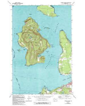
Cypress Island Topo Map Washington
To zoom in, hover over the map of Cypress Island
USGS Topo Quad 48122e6 - 1:24,000 scale
| Topo Map Name: | Cypress Island |
| USGS Topo Quad ID: | 48122e6 |
| Print Size: | ca. 21 1/4" wide x 27" high |
| Southeast Coordinates: | 48.5° N latitude / 122.625° W longitude |
| Map Center Coordinates: | 48.5625° N latitude / 122.6875° W longitude |
| U.S. State: | WA |
| Filename: | o48122e6.jpg |
| Download Map JPG Image: | Cypress Island topo map 1:24,000 scale |
| Map Type: | Topographic |
| Topo Series: | 7.5´ |
| Map Scale: | 1:24,000 |
| Source of Map Images: | United States Geological Survey (USGS) |
| Alternate Map Versions: |
Cypress Island WA 1973, updated 1977 Download PDF Buy paper map Cypress Island WA 1973, updated 1994 Download PDF Buy paper map Cypress Island WA 1997, updated 2003 Download PDF Buy paper map Cypress Island WA 2011 Download PDF Buy paper map Cypress Island WA 2014 Download PDF Buy paper map |
1:24,000 Topo Quads surrounding Cypress Island
> Back to 48122e1 at 1:100,000 scale
> Back to 48122a1 at 1:250,000 scale
> Back to U.S. Topo Maps home
Cypress Island topo map: Gazetteer
Cypress Island: Airports
Cypress Island Airport elevation 293m 961′Cypress Island: Areas
Devils Playground elevation 0m 0′Cypress Island: Bars
Buckeye Shoal elevation 0m 0′City of Seattle Rock elevation 0m 0′
Cypress Reef elevation 0m 0′
Yellow Bluff Reef elevation 0m 0′
Cypress Island: Bays
Deepwater Bay elevation 0m 0′Eagle Harbor elevation 0m 0′
Secret Harbor elevation 0m 0′
Ship Harbor elevation 0m 0′
Strawberry Bay elevation 0m 0′
Cypress Island: Beaches
Pelican Beach elevation 13m 42′Sunset Beach elevation 0m 0′
Cypress Island: Capes
Clark Point elevation 13m 42′Cypress Head elevation 3m 9′
Kellys Point elevation 9m 29′
Reef Point elevation 15m 49′
Shannon Point elevation 8m 26′
Tide Point elevation 2m 6′
Cypress Island: Channels
Bellingham Channel elevation 0m 0′Cypress Island: Cliffs
Eagle Cliff elevation 225m 738′Yellow Bluff elevation 0m 0′
Cypress Island: Dams
Cranberry Lake Dam elevation 83m 272′Cypress Lake East Dam elevation 336m 1102′
Cypress Lake West Dam elevation 336m 1102′
Cypress Island: Islands
Cone Islands elevation 16m 52′Cypress Island elevation 270m 885′
Guemes Island elevation 53m 173′
Sinclair Island elevation 18m 59′
Strawberry Island elevation 35m 114′
Towhead Island elevation 11m 36′
Cypress Island: Lakes
Cannery Lake elevation 4m 13′Duck Lake elevation 90m 295′
Cypress Island: Parks
Cone Islands State Park elevation 16m 52′Cranberry Lake Park elevation 115m 377′
Cypress Island: Populated Places
Indian Village elevation 26m 85′North Beach elevation 10m 32′
Urban elevation 18m 59′
Cypress Island: Reservoirs
Cranberry Lake elevation 83m 272′Cypress Lake elevation 307m 1007′
Cypress Island: Summits
Olivine Hill elevation 182m 597′Cypress Island: Swamps
Stella Swamp elevation 267m 875′Cypress Island digital topo map on disk
Buy this Cypress Island topo map showing relief, roads, GPS coordinates and other geographical features, as a high-resolution digital map file on DVD:


