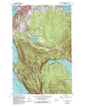
Bellingham South Topo Map Washington
To zoom in, hover over the map of Bellingham South
USGS Topo Quad 48122f4 - 1:24,000 scale
| Topo Map Name: | Bellingham South |
| USGS Topo Quad ID: | 48122f4 |
| Print Size: | ca. 21 1/4" wide x 27" high |
| Southeast Coordinates: | 48.625° N latitude / 122.375° W longitude |
| Map Center Coordinates: | 48.6875° N latitude / 122.4375° W longitude |
| U.S. State: | WA |
| Filename: | o48122f4.jpg |
| Download Map JPG Image: | Bellingham South topo map 1:24,000 scale |
| Map Type: | Topographic |
| Topo Series: | 7.5´ |
| Map Scale: | 1:24,000 |
| Source of Map Images: | United States Geological Survey (USGS) |
| Alternate Map Versions: |
Bellingham South WA 1954, updated 1959 Download PDF Buy paper map Bellingham South WA 1954, updated 1973 Download PDF Buy paper map Bellingham South WA 1954, updated 1984 Download PDF Buy paper map Bellingham South WA 1954, updated 1995 Download PDF Buy paper map Bellingham South WA 1998, updated 2003 Download PDF Buy paper map Bellingham South WA 2011 Download PDF Buy paper map Bellingham South WA 2014 Download PDF Buy paper map |
1:24,000 Topo Quads surrounding Bellingham South
> Back to 48122e1 at 1:100,000 scale
> Back to 48122a1 at 1:250,000 scale
> Back to U.S. Topo Maps home
Bellingham South topo map: Gazetteer
Bellingham South: Airports
Civic Field Parking Area Heliport elevation 38m 124′Bellingham South: Bays
Chuckanut Bay elevation 0m 0′Wildcat Cove elevation 18m 59′
Bellingham South: Capes
Chuckanut Point elevation 0m 0′Dogfish Point elevation 6m 19′
Bellingham South: Channels
Inner Reach elevation 0m 0′Middle Reach elevation 0m 0′
Whatcom Creek Waterway elevation 2m 6′
Bellingham South: Crossings
Lakeway Drive Interchange elevation 56m 183′Lindsay Avenue Interchange elevation 55m 180′
Samish Inn Interchange elevation 164m 538′
South Bellingham Interchange elevation 64m 209′
Bellingham South: Dams
Bullard Dam elevation 160m 524′Lake Padden Dam elevation 142m 465′
Bellingham South: Lakes
Cedar Lake elevation 470m 1541′Fragrance Lake elevation 322m 1056′
Lake Samish elevation 84m 275′
Lizard Lake elevation 573m 1879′
Lost Lake elevation 372m 1220′
Mud Lake elevation 286m 938′
Pine Lake elevation 493m 1617′
Bellingham South: Parks
Arroya Park Reserve elevation 61m 200′Downer Field elevation 42m 137′
East Lake Padden Park elevation 220m 721′
Fairhaven Park elevation 30m 98′
Forest and Cedar Park elevation 66m 216′
Larrabee State Park elevation 348m 1141′
Laurel Park elevation 68m 223′
Lowell Park elevation 100m 328′
Ridgemont Park elevation 127m 416′
Samish Park elevation 89m 291′
Sehome Hill Park elevation 161m 528′
West Lake Padden Park elevation 135m 442′
Bellingham South: Populated Places
Chuckanut elevation 66m 216′Chuckanut Village elevation 5m 16′
Geneva elevation 136m 446′
Happy Valley elevation 140m 459′
Lakeway elevation 106m 347′
South Bellingham elevation 37m 121′
Bellingham South: Reservoirs
Bullard Lake elevation 160m 524′Lake Padden elevation 142m 465′
Bellingham South: Streams
Barnes Creek elevation 86m 282′Chuckanut Creek elevation 36m 118′
Bellingham South: Summits
Chuckanut Mountain elevation 430m 1410′Sehome Hill elevation 192m 629′
Bellingham South digital topo map on disk
Buy this Bellingham South topo map showing relief, roads, GPS coordinates and other geographical features, as a high-resolution digital map file on DVD:


