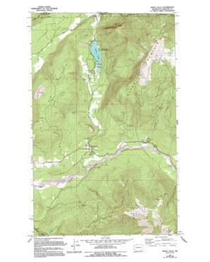
Maple Falls Topo Map Washington
To zoom in, hover over the map of Maple Falls
USGS Topo Quad 48122h1 - 1:24,000 scale
| Topo Map Name: | Maple Falls |
| USGS Topo Quad ID: | 48122h1 |
| Print Size: | ca. 21 1/4" wide x 27" high |
| Southeast Coordinates: | 48.875° N latitude / 122° W longitude |
| Map Center Coordinates: | 48.9375° N latitude / 122.0625° W longitude |
| U.S. State: | WA |
| Filename: | o48122h1.jpg |
| Download Map JPG Image: | Maple Falls topo map 1:24,000 scale |
| Map Type: | Topographic |
| Topo Series: | 7.5´ |
| Map Scale: | 1:24,000 |
| Source of Map Images: | United States Geological Survey (USGS) |
| Alternate Map Versions: |
Maple Falls WA 1972, updated 1976 Download PDF Buy paper map Maple Falls WA 2011 Download PDF Buy paper map Maple Falls WA 2014 Download PDF Buy paper map |
1:24,000 Topo Quads surrounding Maple Falls
Sumas |
Kendall |
Maple Falls |
Glacier |
Bearpaw Mountain |
Lawrence |
Deming |
Canyon Lake |
Groat Mountain |
Mount Baker |
Lake Whatcom |
Acme |
Cavanaugh Creek |
Twin Sisters Mountain |
Baker Pass |
> Back to 48122e1 at 1:100,000 scale
> Back to 48122a1 at 1:250,000 scale
> Back to U.S. Topo Maps home
Maple Falls topo map: Gazetteer
Maple Falls: Airports
Kendal Airstrip elevation 170m 557′Maple Falls: Lakes
Silver Lake elevation 233m 764′Maple Falls: Parks
Silver Lake Park elevation 242m 793′Maple Falls: Populated Places
Maple Falls elevation 197m 646′Maple Falls: Streams
Boulder Creek elevation 182m 597′Doaks Creek elevation 224m 734′
Maple Creek elevation 154m 505′
Wildcat Creek elevation 208m 682′
Maple Falls: Summits
Black Mountain elevation 1359m 4458′Red Mountain elevation 683m 2240′
Maple Falls digital topo map on disk
Buy this Maple Falls topo map showing relief, roads, GPS coordinates and other geographical features, as a high-resolution digital map file on DVD:


