Bertrand Creek Topo Map Washington
To zoom in, hover over the map of Bertrand Creek
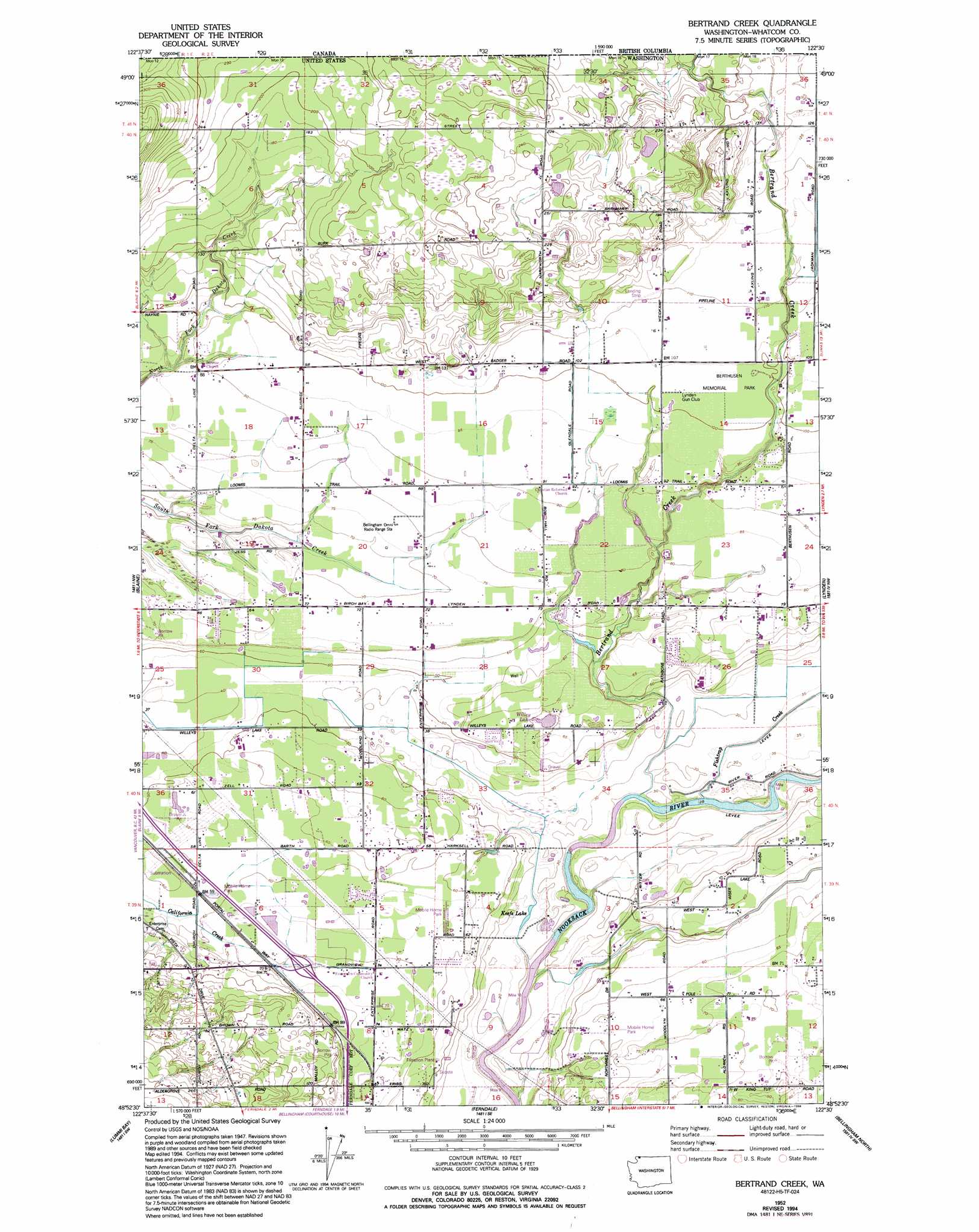
USGS Topo Quad 48122h5 - 1:24,000 scale
| Topo Map Name: | Bertrand Creek |
| USGS Topo Quad ID: | 48122h5 |
| Print Size: | ca. 21 1/4" wide x 27" high |
| Southeast Coordinates: | 48.875° N latitude / 122.5° W longitude |
| Map Center Coordinates: | 48.9375° N latitude / 122.5625° W longitude |
| U.S. State: | WA |
| Filename: | o48122h5.jpg |
| Download Map JPG Image: | Bertrand Creek topo map 1:24,000 scale |
| Map Type: | Topographic |
| Topo Series: | 7.5´ |
| Map Scale: | 1:24,000 |
| Source of Map Images: | United States Geological Survey (USGS) |
| Alternate Map Versions: |
Bertrand Creek WA 1952, updated 1954 Download PDF Buy paper map Bertrand Creek WA 1952, updated 1974 Download PDF Buy paper map Bertrand Creek WA 1952, updated 1994 Download PDF Buy paper map Bertrand Creek WA 2011 Download PDF Buy paper map Bertrand Creek WA 2014 Download PDF Buy paper map |
1:24,000 Topo Quads surrounding Bertrand Creek
Birch Point |
Blaine |
Bertrand Creek |
Lynden |
Sumas |
Lummi Bay |
Ferndale |
Bellingham North |
Lawrence |
|
Mount Constitution |
Lummi Island |
Eliza Island |
Bellingham South |
Lake Whatcom |
> Back to 48122e1 at 1:100,000 scale
> Back to 48122a1 at 1:250,000 scale
> Back to U.S. Topo Maps home
Bertrand Creek topo map: Gazetteer
Bertrand Creek: Airports
Meadow Mist Airport elevation 18m 59′Bertrand Creek: Lakes
Keefe Lake elevation 8m 26′Willey Lake elevation 18m 59′
Bertrand Creek: Populated Places
Delta elevation 37m 121′Bertrand Creek: Streams
Bertrand Creek elevation 8m 26′Fishtrap Creek elevation 9m 29′
Bertrand Creek digital topo map on disk
Buy this Bertrand Creek topo map showing relief, roads, GPS coordinates and other geographical features, as a high-resolution digital map file on DVD: