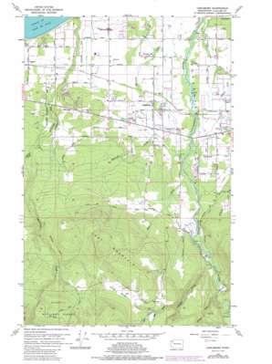
Carlsborg Topo Map Washington
To zoom in, hover over the map of Carlsborg
USGS Topo Quad 48123a2 - 1:24,000 scale
| Topo Map Name: | Carlsborg |
| USGS Topo Quad ID: | 48123a2 |
| Print Size: | ca. 21 1/4" wide x 27" high |
| Southeast Coordinates: | 48° N latitude / 123.125° W longitude |
| Map Center Coordinates: | 48.0625° N latitude / 123.1875° W longitude |
| U.S. State: | WA |
| Filename: | o48123a2.jpg |
| Download Map JPG Image: | Carlsborg topo map 1:24,000 scale |
| Map Type: | Topographic |
| Topo Series: | 7.5´ |
| Map Scale: | 1:24,000 |
| Source of Map Images: | United States Geological Survey (USGS) |
| Alternate Map Versions: |
Carlsborg WA 1956, updated 1958 Download PDF Buy paper map Carlsborg WA 1956, updated 1968 Download PDF Buy paper map Carlsborg WA 1956, updated 1978 Download PDF Buy paper map Carlsborg WA 1956, updated 1985 Download PDF Buy paper map Carlsborg WA 2011 Download PDF Buy paper map Carlsborg WA 2014 Download PDF Buy paper map |
| FStopo: | US Forest Service topo Carlsborg is available: Download FStopo PDF Download FStopo TIF |
1:24,000 Topo Quads surrounding Carlsborg
Ediz Hook |
Dungeness |
|||
Port Angeles |
Morse Creek |
Carlsborg |
Sequim |
Gardiner |
Mount Angeles |
Maiden Peak |
Tyler Peak |
Mount Zion |
Uncas |
Mccartney Peak |
Wellesley Peak |
Mount Deception |
Mount Townsend |
Mount Walker |
> Back to 48123a1 at 1:100,000 scale
> Back to 48122a1 at 1:250,000 scale
> Back to U.S. Topo Maps home
Carlsborg topo map: Gazetteer
Carlsborg: Airports
Grand View International Airport elevation 40m 131′Sequim Valley Airport elevation 43m 141′
Carlsborg: Basins
Texas Valley elevation 445m 1459′Carlsborg: Dams
Epperson Creek Fish Pond Dam elevation 26m 85′Rex Aldrich Dam Number One elevation 37m 121′
Rex Aldrich Dam Number Two elevation 38m 124′
Solmar Lake Dam elevation 70m 229′
Carlsborg: Populated Places
Agnew elevation 50m 164′Carlsborg elevation 54m 177′
Rena elevation 52m 170′
River Road elevation 96m 314′
Carlsborg: Reservoirs
Epperson Creek Fish Pond elevation 26m 85′Rex Aldrich Reservoir elevation 37m 121′
Solmar Lake elevation 70m 229′
Carlsborg: Streams
Bear Creek elevation 90m 295′Canyon Creek elevation 156m 511′
Caraco Creek elevation 178m 583′
Owl Creek elevation 39m 127′
Pats Creek elevation 260m 853′
Pederson Creek elevation 133m 436′
Rock Creek elevation 355m 1164′
Carlsborg: Summits
Lost Mountain elevation 629m 2063′Carlsborg digital topo map on disk
Buy this Carlsborg topo map showing relief, roads, GPS coordinates and other geographical features, as a high-resolution digital map file on DVD:


