Dickey Lake Topo Map Washington
To zoom in, hover over the map of Dickey Lake
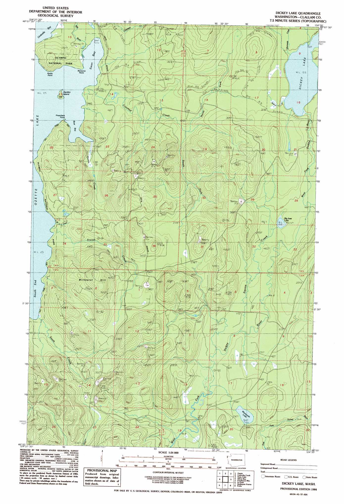
USGS Topo Quad 48124a5 - 1:24,000 scale
| Topo Map Name: | Dickey Lake |
| USGS Topo Quad ID: | 48124a5 |
| Print Size: | ca. 21 1/4" wide x 27" high |
| Southeast Coordinates: | 48° N latitude / 124.5° W longitude |
| Map Center Coordinates: | 48.0625° N latitude / 124.5625° W longitude |
| U.S. State: | WA |
| Filename: | o48124a5.jpg |
| Download Map JPG Image: | Dickey Lake topo map 1:24,000 scale |
| Map Type: | Topographic |
| Topo Series: | 7.5´ |
| Map Scale: | 1:24,000 |
| Source of Map Images: | United States Geological Survey (USGS) |
| Alternate Map Versions: |
Dickey Lake WA 1984, updated 1984 Download PDF Buy paper map Dickey Lake WA 2011 Download PDF Buy paper map Dickey Lake WA 2014 Download PDF Buy paper map |
1:24,000 Topo Quads surrounding Dickey Lake
Makah Bay |
Neah Bay |
Sekiu River |
Clallam Bay |
Ozette |
Umbrella Creek |
Hoko Falls |
Ellis Mountain |
Allens Bay |
Dickey Lake |
Gunderson Mountain |
Lake Pleasant |
La Push |
Quillayute Prairie |
Forks |
Reade Hill |
Toleak Point |
Hoh Head |
Anderson Creek |
> Back to 48124a1 at 1:100,000 scale
> Back to 48124a1 at 1:250,000 scale
> Back to U.S. Topo Maps home
Dickey Lake topo map: Gazetteer
Dickey Lake: Bays
Boot Bay elevation 10m 32′South End elevation 10m 32′
Swan Bay elevation 10m 32′
Umbrella Bay elevation 10m 32′
Dickey Lake: Capes
Bensons Point elevation 10m 32′Preachers Point elevation 12m 39′
Rocky Point elevation 17m 55′
Dickey Lake: Islands
Garden Island elevation 13m 42′Dickey Lake: Lakes
Big Joes Lake elevation 47m 154′Dickey Lake elevation 60m 196′
Wentworth Lake elevation 47m 154′
Dickey Lake: Streams
Barbour Creek elevation 60m 196′Big River elevation 10m 32′
Crooked Creek elevation 10m 32′
Elk Creek elevation 10m 32′
Middle Fork Dickey River elevation 60m 196′
North Fork Crooked Creek elevation 43m 141′
Quinn Creek elevation 12m 39′
Sands Creek elevation 62m 203′
Siwash Creek elevation 10m 32′
South Creek elevation 11m 36′
South Fork Crooked Creek elevation 32m 104′
Squaw Creek elevation 25m 82′
Stampede Creek elevation 60m 196′
Dickey Lake digital topo map on disk
Buy this Dickey Lake topo map showing relief, roads, GPS coordinates and other geographical features, as a high-resolution digital map file on DVD: