Umbrella Creek Topo Map Washington
To zoom in, hover over the map of Umbrella Creek
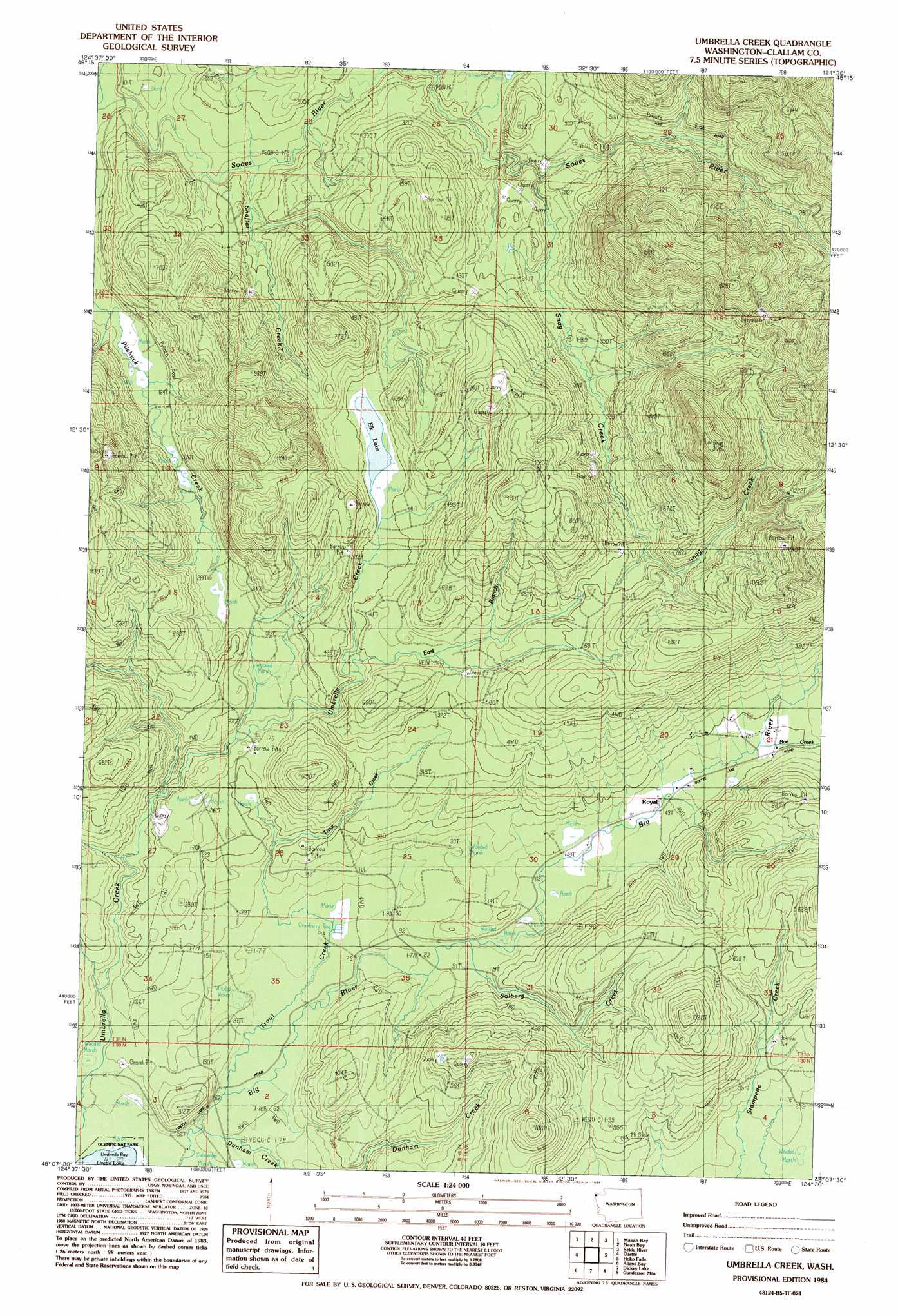
USGS Topo Quad 48124b5 - 1:24,000 scale
| Topo Map Name: | Umbrella Creek |
| USGS Topo Quad ID: | 48124b5 |
| Print Size: | ca. 21 1/4" wide x 27" high |
| Southeast Coordinates: | 48.125° N latitude / 124.5° W longitude |
| Map Center Coordinates: | 48.1875° N latitude / 124.5625° W longitude |
| U.S. State: | WA |
| Filename: | o48124b5.jpg |
| Download Map JPG Image: | Umbrella Creek topo map 1:24,000 scale |
| Map Type: | Topographic |
| Topo Series: | 7.5´ |
| Map Scale: | 1:24,000 |
| Source of Map Images: | United States Geological Survey (USGS) |
| Alternate Map Versions: |
Umbrella Creek WA 1984, updated 1984 Download PDF Buy paper map Umbrella Creek WA 2011 Download PDF Buy paper map Umbrella Creek WA 2014 Download PDF Buy paper map |
1:24,000 Topo Quads surrounding Umbrella Creek
Cape Flattery |
Waadah Island |
Makah Bay |
||
Neah Bay |
Sekiu River |
Clallam Bay |
Ozette |
Umbrella Creek |
Hoko Falls |
Ellis Mountain |
Allens Bay |
Dickey Lake |
Gunderson Mountain |
Lake Pleasant |
La Push |
Quillayute Prairie |
Forks |
Reade Hill |
> Back to 48124a1 at 1:100,000 scale
> Back to 48124a1 at 1:250,000 scale
> Back to U.S. Topo Maps home
Umbrella Creek topo map: Gazetteer
Umbrella Creek: Lakes
Elk Lake elevation 120m 393′Umbrella Creek: Streams
Boe Creek elevation 54m 177′Dunham Creek elevation 14m 45′
East Branch Umbrella Creek elevation 107m 351′
Shafter Creek elevation 62m 203′
Snag Creek elevation 62m 203′
Solberg Creek elevation 32m 104′
Trout Creek elevation 14m 45′
Umbrella Creek: Summits
Snag Peak elevation 620m 2034′Umbrella Creek digital topo map on disk
Buy this Umbrella Creek topo map showing relief, roads, GPS coordinates and other geographical features, as a high-resolution digital map file on DVD: