Cape Flattery Topo Map Washington
To zoom in, hover over the map of Cape Flattery
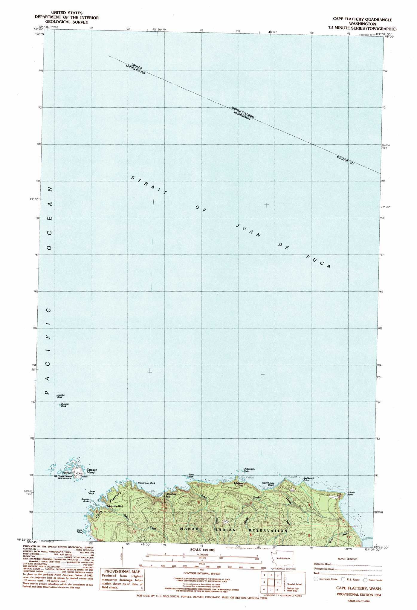
USGS Topo Quad 48124d6 - 1:24,000 scale
| Topo Map Name: | Cape Flattery |
| USGS Topo Quad ID: | 48124d6 |
| Print Size: | ca. 21 1/4" wide x 27" high |
| Southeast Coordinates: | 48.375° N latitude / 124.625° W longitude |
| Map Center Coordinates: | 48.4375° N latitude / 124.6875° W longitude |
| U.S. State: | WA |
| Filename: | o48124d6.jpg |
| Download Map JPG Image: | Cape Flattery topo map 1:24,000 scale |
| Map Type: | Topographic |
| Topo Series: | 7.5´ |
| Map Scale: | 1:24,000 |
| Source of Map Images: | United States Geological Survey (USGS) |
| Alternate Map Versions: |
Cape Flattery WA 1984, updated 1984 Download PDF Buy paper map Cape Flattery WA 2011 Download PDF Buy paper map Cape Flattery WA 2014 Download PDF Buy paper map |
1:24,000 Topo Quads surrounding Cape Flattery
Cape Flattery |
Waadah Island |
Makah Bay |
||
Neah Bay |
Sekiu River |
Ozette |
Umbrella Creek |
Hoko Falls |
> Back to 48124a1 at 1:100,000 scale
> Back to 48124a1 at 1:250,000 scale
> Back to U.S. Topo Maps home
Cape Flattery topo map: Gazetteer
Cape Flattery: Arches
Look-Through Rock elevation 12m 39′Cape Flattery: Bars
Chibahdehl Rocks elevation 0m 0′Duncan Rock elevation 0m 0′
Fuca Pillar elevation 0m 0′
Jones Rock elevation 0m 0′
Kessiso Rocks elevation 0m 0′
Mushroom Rock elevation 0m 0′
Slant Rock elevation 0m 0′
Cape Flattery: Bays
Hole-in-the-Wall elevation 0m 0′Cape Flattery: Beaches
Warmhouse Beach elevation 3m 9′Cape Flattery: Capes
Cape Flattery elevation 120m 393′Koitlah Point elevation 0m 0′
Kydikabbit Point elevation 0m 0′
Cape Flattery: Falls
Titacoclos Falls elevation 23m 75′Cape Flattery: Islands
Duntze Rock elevation 0m 0′Tatoosh Island elevation 18m 59′
Cape Flattery: Populated Places
Classet elevation 132m 433′Midway elevation 5m 16′
Cape Flattery: Ridges
Sah-da-ped-thl elevation 0m 0′Cape Flattery: Streams
Beach Creek elevation 0m 0′Classet Creek elevation 3m 9′
Flattery Creek elevation 3m 9′
Middle Creek elevation 0m 0′
Scow Creek elevation 0m 0′
Cape Flattery digital topo map on disk
Buy this Cape Flattery topo map showing relief, roads, GPS coordinates and other geographical features, as a high-resolution digital map file on DVD: