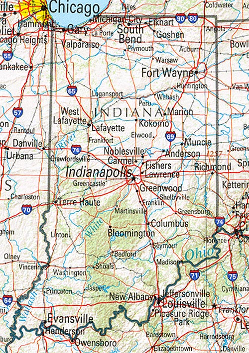
Reference physical Map of Indiana

Physical map showing vegetation and urban centers of Indiana state.
To zoom in, hover over the Reference physical Map of IN State
Download Indiana Reference Map
Original high-resolution image: Reference Indiana Map
Reference Indiana Map
This reference map of Indiana is free and available for download. You can print this physical map and use it in your projects. The original source of this Reference physical Map of Indiana is: University of Texas. This geography map is a static image in jpg format. You can save it as an image by clicking on the labeled map to access the original Indiana Reference Map file. The map covers the following area: state, Indiana, showing urban centers and vegetation of Indiana.