Eagle Pass Topo Map Texas
To zoom in, hover over the map of Eagle Pass
USGS Topo Map 28100e1 - 1:100,000 scale
| Topo Map Name: | Eagle Pass |
| USGS Topo Quad ID: | 28100e1 |
| Print Size: | ca. 39" wide x 24" high |
| Southeast Coordinates: | 28.5° N latitude / 100° W longitude |
| Map Center Coordinates: | 28.75° N latitude / 100.5° W longitude |
| U.S. State: | TX |
| Filename: | 28100e1.jpg |
| Download Map JPG Image: | Eagle Pass topo map 1:100,000 scale |
| Map Type: | Topographic |
| Topo Series: | 30´x60´ |
| Map Scale: | 1:100,000 |
| Source of Map Images: | United States Geological Survey (USGS) |
| Alternate Map Versions: |
Eagle Pass TX 1985, updated 1985 Download PDF Buy paper map |
1:100,000 Topos surrounding Eagle Pass
Amistead Village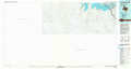 |
Del Rio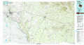 |
Uvalde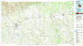 |
Eagle Pass |
Crystal City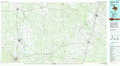 |
|
San Ambrosia Creek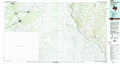 |
Cotulla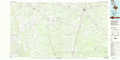 |
> Back to 28100a1 at 1:250,000 scale
> Back to U.S. Topo Maps home
1:24,000 Topo Quads covered by the spatial extent of this 100k map (Eagle Pass)
|
Quemado West 
|
Quemado East 
|
Paloma 
|
Trosado Tank 
|
Chacon Creek Nw 
|
Chacon Creek Ne 
|
||
|
Quemado Se 
|
Deadmans Hill 
|
Indian Tank 
|
Chacon Creek Sw 
|
Chacon Creek Se 
|
|||
|
Eagle Pass West 
|
Eagle Pass East 
|
Eagle Pass Ne 
|
Sacatosa Tank 
|
Cometa 
|
|||
|
Eagle Pass Sw 
|
El Indio 
|
Farias Ranch 
|
Cayetano Creek 
|
