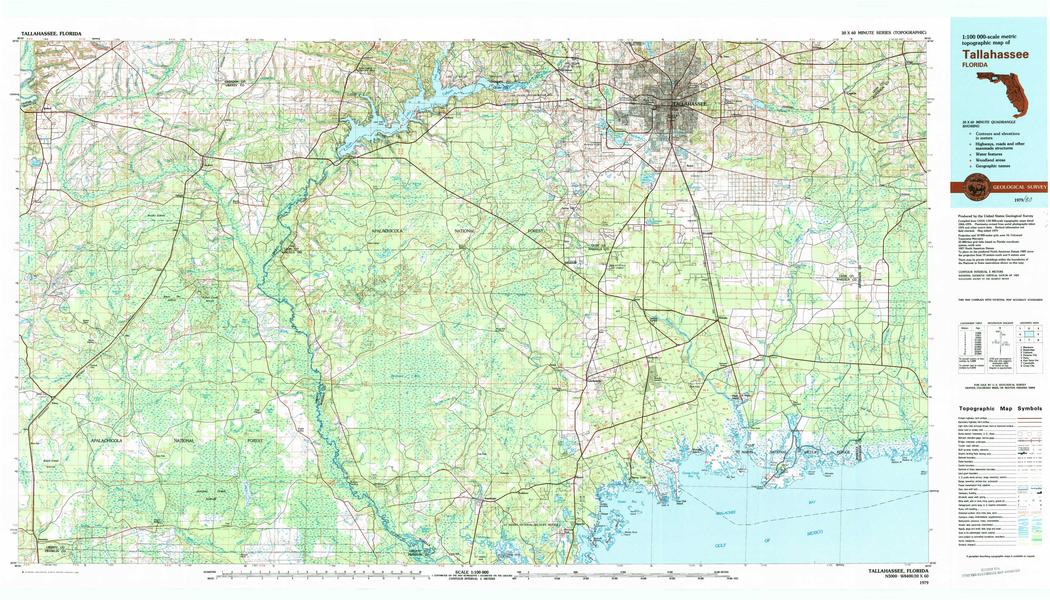
Tallahassee Topo Map Florida
To zoom in, hover over the map of Tallahassee
USGS Topo Map 30084a1 - 1:100,000 scale
| Topo Map Name: | Tallahassee |
| USGS Topo Quad ID: | 30084a1 |
| Print Size: | ca. 39" wide x 24" high |
| Southeast Coordinates: | 30° N latitude / 84° W longitude |
| Map Center Coordinates: | 30.25° N latitude / 84.5° W longitude |
| U.S. State: | FL |
| Filename: | 30084a1.jpg |
| Download Map JPG Image: | Tallahassee topo map 1:100,000 scale |
| Map Type: | Topographic |
| Topo Series: | 30´x60´ |
| Map Scale: | 1:100,000 |
| Source of Map Images: | United States Geological Survey (USGS) |
| Alternate Map Versions: |
Tallahassee FL 1979, updated 1980 Download PDF Buy paper map |
1:100,000 Topos surrounding Tallahassee
Marianna |
Bainbridge |
Valdosta |
Panama City |
Tallahassee |
Perry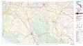 |
Port Saint Joe |
Carrabelle |
Cross City |
> Back to 30084a1 at 1:250,000 scale
> Back to U.S. Topo Maps home
1:24,000 Topo Quads covered by the spatial extent of this 100k map (Tallahassee)
|
Bristol 
|
Hosford 
|
Bloxham 
|
Lake Talquin 
|
Midway 
|
Tallahassee 
|
Lafayette 
|
Lloyd 
|
|
Woods 
|
Telogia 
|
Ward 
|
Lake Talquin Se 
|
Hilliardville 
|
Lake Munson 
|
Woodville 
|
Cody 
|
|
Wilma 
|
Queens Bay 
|
Smith Creek 
|
Bradwell Bay 
|
Crawfordville West 
|
Crawfordville East 
|
Saint Marks 
|
Saint Marks Ne 
|
|
Sumatra 
|
Owens Bridge 
|
Thousand Yard Bay 
|
Sanborn 
|
Sopchoppy 
|
Spring Creek 
|
Sprague Island 
|
Cobb Rocks 
|