Huntsville Topo Map Texas
To zoom in, hover over the map of Huntsville
USGS Topo Map 30095e1 - 1:100,000 scale
| Topo Map Name: | Huntsville |
| USGS Topo Quad ID: | 30095e1 |
| Print Size: | ca. 39" wide x 24" high |
| Southeast Coordinates: | 30.5° N latitude / 95° W longitude |
| Map Center Coordinates: | 30.75° N latitude / 95.5° W longitude |
| U.S. State: | TX |
| Filename: | 30095e1.jpg |
| Download Map JPG Image: | Huntsville topo map 1:100,000 scale |
| Map Type: | Topographic |
| Topo Series: | 30´x60´ |
| Map Scale: | 1:100,000 |
| Source of Map Images: | United States Geological Survey (USGS) |
| Alternate Map Versions: |
Huntsville TX 1985, updated 1985 Download PDF Buy paper map Huntsville TX 1985, updated 1992 Download PDF Buy paper map |
1:100,000 Topos surrounding Huntsville
Marlin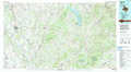 |
Crockett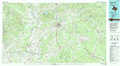 |
Lufkin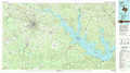 |
Bryan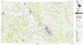 |
Huntsville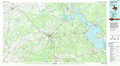 |
Livingston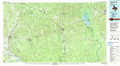 |
Brenham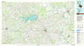 |
Conroe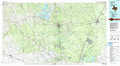 |
Beaumont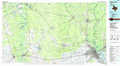 |
> Back to 30094a1 at 1:250,000 scale
> Back to U.S. Topo Maps home
1:24,000 Topo Quads covered by the spatial extent of this 100k map (Huntsville)
|
Madisonville 
|
Connor 
|
Baker Lake 
|
Wyser Bottom 
|
Trinity West 
|
Trinity East 
|
Chita 
|
Colita 
|
|
Bedias 
|
Steep Branch 
|
Crabbs Prairie 
|
Pine Prairie 
|
Riverside 
|
Staley 
|
Carlisle 
|
Onalaska 
|
|
Singleton 
|
Loma 
|
Galilee 
|
Huntsville 
|
Phelps 
|
Oakhurst 
|
Stephen Creek 
|
Blanchard 
|
|
Roans Prairie 
|
Richards 
|
San Jacinto 
|
Moore Grove 
|
New Waverly 
|
Maynard 
|
Coldspring 
|
Camilla 
|
