Dothan Topo Map Alabama
To zoom in, hover over the map of Dothan
USGS Topo Map 31085a1 - 1:100,000 scale
| Topo Map Name: | Dothan |
| USGS Topo Quad ID: | 31085a1 |
| Print Size: | ca. 39" wide x 24" high |
| Southeast Coordinates: | 31° N latitude / 85° W longitude |
| Map Center Coordinates: | 31.25° N latitude / 85.5° W longitude |
| U.S. States: | AL, GA, FL |
| Filename: | 31085a1.jpg |
| Download Map JPG Image: | Dothan topo map 1:100,000 scale |
| Map Type: | Topographic |
| Topo Series: | 30´x60´ |
| Map Scale: | 1:100,000 |
| Source of Map Images: | United States Geological Survey (USGS) |
| Alternate Map Versions: | none available in database |
1:100,000 Topos surrounding Dothan
Greenville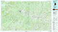 |
Troy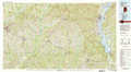 |
Albany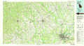 |
Andalusia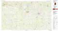 |
Dothan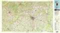 |
Camilla |
Crestview |
Marianna |
Bainbridge |
> Back to 31084a1 at 1:250,000 scale
> Back to U.S. Topo Maps home
1:24,000 Topo Quads covered by the spatial extent of this 100k map (Dothan)
|
New Brockton 
|
Enterprise Ne 
|
Ozark 
|
Ewell 
|
Echo 
|
Newville 
|
Haleburg 
|
Columbia Ne 
|
|
Goodman 
|
Enterprise 
|
Daleville 
|
Pinckard 
|
Midland City 
|
Headland 
|
Sigma 
|
Columbia 
|
|
Coffee Springs 
|
Bellwood 
|
Clayhatchee 
|
Malvern 
|
Dothan West 
|
Dothan East 
|
Ashford 
|
Gordon 
|
|
Geneva West 
|
Geneva East 
|
Hartford 
|
Slocomb 
|
Madrid 
|
Cottonwood 
|
Grangeburg 
|
Saffold 
|
