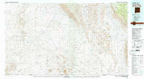
Crow Flats Topo Map New Mexico

To zoom in, hover over the map of Crow Flats

USGS Topo Map 32105a1 - 1:100,000 scale

Topo Map Name: Crow Flats
USGS Topo Quad ID: 32105a1
Print Size: ca. 39" wide x 24" high
Southeast Coordinates: 32° N latitude / 105° W longitude
Map Center Coordinates: 32.25° N latitude / 105.5° W longitude
U.S. States: NM, TX
Filename: 32105a1.jpg
Download Map JPG Image: Crow Flats topo map 1:100,000 scale
Map Type: Topographic
Topo Series: 30´x60´
Map Scale: 1:100,000
Source of Map Images: United States Geological Survey (USGS)
Alternate Map Versions: Crow Flats NM 1979, updated 1979 Download PDF Buy paper map
Crow Flats NM 1979, updated 1979 Download PDF Buy paper map

1:100,000 Topos surrounding Crow Flats

White Sands
White Sands USGS topographic map 32106e1
Alamogordo
Alamogordo USGS topographic map 32105e1
Artesia
Artesia USGS topographic map 32104e1
Las Cruces
Las Cruces USGS topographic map 32106a1
Crow Flats
Crow Flats USGS topographic map 32105a1
Carlsbad
Carlsbad USGS topographic map 32104a1
El Paso
El Paso USGS topographic map 31106e1
Dell City
Dell City USGS topographic map 31105e1
Guadalupe Peak
Guadalupe Peak USGS topographic map 31104e1

> Back to 32104a1 at 1:250,000 scale
> Back to U.S. Topo Maps home

1:24,000 Topo Quads covered by the spatial extent of this 100k map (Crow Flats)

Wilde Tank
Wilde Tank USGS topographic map 32105d8
Otero Mesa North
Otero Mesa North USGS topographic map 32105d7
El Paso Draw
El Paso Draw USGS topographic map 32105d6
Sixteen Canyon
Sixteen Canyon USGS topographic map 32105d5
Indian Draw
Indian Draw USGS topographic map 32105d4
Cornucopia Ranch
Cornucopia Ranch USGS topographic map 32105d3
Tanner Ranch
Tanner Ranch USGS topographic map 32105d2
Panama Ranch
Panama Ranch USGS topographic map 32105d1
Mack Tanks
Mack Tanks USGS topographic map 32105c8
Otero Mesa South
Otero Mesa South USGS topographic map 32105c7
Stone Well
Stone Well USGS topographic map 32105c6
Stockard Well
Stockard Well USGS topographic map 32105c5
Cleones Tank
Cleones Tank USGS topographic map 32105c4
Cornucopia Ranch Se
Cornucopia Ranch Se USGS topographic map 32105c3
Hackberry Hill
Hackberry Hill USGS topographic map 32105c2
Gowdy Ranch
Gowdy Ranch USGS topographic map 32105c1
Owl Tank Canyon West
Owl Tank Canyon West USGS topographic map 32105b8
Owl Tank Canyon East
Owl Tank Canyon East USGS topographic map 32105b7
B T Ranch
B T Ranch USGS topographic map 32105b6
Alamo Mountain Ne
Alamo Mountain Ne USGS topographic map 32105b5
Shiloh Hills
Shiloh Hills USGS topographic map 32105b4
Van Winkle Lake
Van Winkle Lake USGS topographic map 32105b3
Lewis Canyon
Lewis Canyon USGS topographic map 32105b2
Sheep Draw
Sheep Draw USGS topographic map 32105b1
Mountain Tank
Mountain Tank USGS topographic map 32105a8
Alamo Mountain
Alamo Mountain USGS topographic map 32105a7
Alamo Mountain
Alamo Mountain USGS topographic map 32105a6
Cornudas Mountain
Cornudas Mountain USGS topographic map 32105a5
Mcveigh Hills
Mcveigh Hills USGS topographic map 32105a4
Shiloh Hills Se
Shiloh Hills Se USGS topographic map 32105a3
Culp Draw
Culp Draw USGS topographic map 32105a2
Cienega School
Cienega School USGS topographic map 32105a1
Crow Flats topographical map