Hatch Topo Map New Mexico
To zoom in, hover over the map of Hatch
USGS Topo Map 32107e1 - 1:100,000 scale
| Topo Map Name: | Hatch |
| USGS Topo Quad ID: | 32107e1 |
| Print Size: | ca. 39" wide x 24" high |
| Southeast Coordinates: | 32.5° N latitude / 107° W longitude |
| Map Center Coordinates: | 32.75° N latitude / 107.5° W longitude |
| U.S. State: | NM |
| Filename: | 32107e1.jpg |
| Download Map JPG Image: | Hatch topo map 1:100,000 scale |
| Map Type: | Topographic |
| Topo Series: | 30´x60´ |
| Map Scale: | 1:100,000 |
| Source of Map Images: | United States Geological Survey (USGS) |
| Alternate Map Versions: |
Hatch NM 1982, updated 1982 Download PDF Buy paper map |
1:100,000 Topos surrounding Hatch
Mogollon Mountains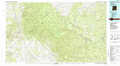 |
Truth Or Consequences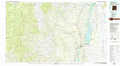 |
Tularosa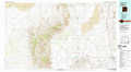 |
Silver City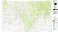 |
Hatch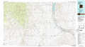 |
White Sands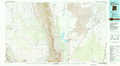 |
Lordsburg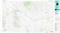 |
Deming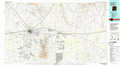 |
Las Cruces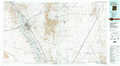 |
> Back to 32106a1 at 1:250,000 scale
> Back to U.S. Topo Maps home
1:24,000 Topo Quads covered by the spatial extent of this 100k map (Hatch)
|
Hendricks Peak 
|
Hillsboro Peak 
|
Kingston 
|
Hillsboro 
|
Skute Stone Arroyo 
|
Caballo 
|
Apache Gap 
|
Upham 
|
|
San Lorenzo 
|
Maverick Mountain 
|
Pa Mountain 
|
Mcclede Mountain 
|
Clark Spring Canyon 
|
Garfield 
|
Mcleod Tank 
|
Alivio 
|
|
Whitehorse Mountain 
|
Dwyer 
|
Whiterock Mountain 
|
Lake Valley 
|
Jug Canyon 
|
Arroyo Cuervo 
|
Hatch 
|
Rincon 
|
|
Taylor Mountain 
|
Faywood Se 
|
Ok Canyon 
|
Greg Hills 
|
Nutt 
|
Hockett 
|
Souse Springs 
|
Sierra Alta 
|
