Milledgeville Topo Map Georgia
To zoom in, hover over the map of Milledgeville
USGS Topo Map 33083a1 - 1:100,000 scale
| Topo Map Name: | Milledgeville |
| USGS Topo Quad ID: | 33083a1 |
| Print Size: | ca. 39" wide x 24" high |
| Southeast Coordinates: | 33° N latitude / 83° W longitude |
| Map Center Coordinates: | 33.25° N latitude / 83.5° W longitude |
| U.S. State: | GA |
| Filename: | 33083a1.jpg |
| Download Map JPG Image: | Milledgeville topo map 1:100,000 scale |
| Map Type: | Topographic |
| Topo Series: | 30´x60´ |
| Map Scale: | 1:100,000 |
| Source of Map Images: | United States Geological Survey (USGS) |
| Alternate Map Versions: |
Milledgeville GA 1981, updated 1981 Download PDF Buy paper map |
1:100,000 Topos surrounding Milledgeville
Atlanta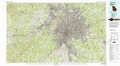 |
Athens |
Clark Hill Lake |
Griffin |
Milledgeville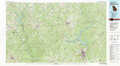 |
Thomson |
Thomaston |
Macon |
Dublin |
> Back to 33082a1 at 1:250,000 scale
> Back to U.S. Topo Maps home
1:24,000 Topo Quads covered by the spatial extent of this 100k map (Milledgeville)
|
Worthville 
|
Stewart 
|
Farrar 
|
Shady Dale 
|
Rock Eagle Lake 
|
Harmony 
|
Liberty 
|
White Plains 
|
|
Jackson 
|
Lloyd Shoals Dam 
|
Monticello 
|
Smithboro 
|
Eatonton 
|
Meda 
|
Rockville 
|
Shoulderbone 
|
|
Indian Springs 
|
Berner 
|
Hillsboro 
|
Stanfordville 
|
Resseaus Crossroads 
|
Lake Sinclair West 
|
Lake Sinclair East 
|
Devereux 
|
|
Forsyth 
|
East Juliette 
|
Dames Ferry 
|
Gray 
|
Haddock 
|
Browns Crossing 
|
Milledgeville 
|
Friendship 
|
