Globe Topo Map Arizona
To zoom in, hover over the map of Globe
USGS Topo Map 33110a1 - 1:100,000 scale
| Topo Map Name: | Globe |
| USGS Topo Quad ID: | 33110a1 |
| Print Size: | ca. 39" wide x 24" high |
| Southeast Coordinates: | 33° N latitude / 110° W longitude |
| Map Center Coordinates: | 33.25° N latitude / 110.5° W longitude |
| U.S. State: | AZ |
| Filename: | 33110a1.jpg |
| Download Map JPG Image: | Globe topo map 1:100,000 scale |
| Map Type: | Topographic |
| Topo Series: | 30´x60´ |
| Map Scale: | 1:100,000 |
| Source of Map Images: | United States Geological Survey (USGS) |
| Alternate Map Versions: |
Globe AZ 1986, updated 1986 Download PDF Buy paper map Globe AZ 1986, updated 1986 Download PDF Buy paper map |
1:100,000 Topos surrounding Globe
Theodore Roosevelt Lake |
Seneca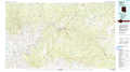 |
Nutrioso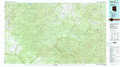 |
Mesa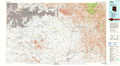 |
Globe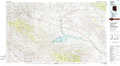 |
Clifton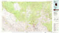 |
Casa Grande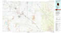 |
Mammoth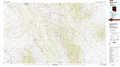 |
Safford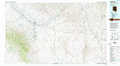 |
> Back to 33110a1 at 1:250,000 scale
> Back to U.S. Topo Maps home
1:24,000 Topo Quads covered by the spatial extent of this 100k map (Globe)
|
Inspiration 
|
Globe 
|
Cammerman Wash 
|
Dourine Canyon 
|
Natural Corral 
|
Sontag Mesa 
|
Bronco Gulch 
|
Ash Creek Ne 
|
|
Pinal Ranch 
|
Pinal Peak 
|
Cutter 
|
Bucket Mountain 
|
San Carlos 
|
Mount Triplet 
|
Branaman Spring 
|
Ash Creek Ranch 
|
|
Hot Tamale Peak 
|
El Capitan Mountain 
|
Mescal Warm Spring 
|
Coolidge Dam 
|
San Carlos Reservoir 
|
Dewey Flat 
|
Calva 
|
Bylas 
|
|
Kearny 
|
Hayden 
|
Christmas 
|
Jerusalem Mountain 
|
Rawhide Mountain 
|
Mount Turnbull 
|
Beargrass Basin 
|
Geronimo 
|
