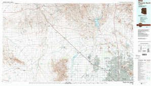
Phoenix North Topo Map Arizona

To zoom in, hover over the map of Phoenix North

USGS Topo Map 33112e1 - 1:100,000 scale

Topo Map Name: Phoenix North
USGS Topo Quad ID: 33112e1
Print Size: ca. 39" wide x 24" high
Southeast Coordinates: 33.5° N latitude / 112° W longitude
Map Center Coordinates: 33.75° N latitude / 112.5° W longitude
U.S. State: AZ
Filename: 33112e1.jpg
Download Map JPG Image: Phoenix North topo map 1:100,000 scale
Map Type: Topographic
Topo Series: 30´x60´
Map Scale: 1:100,000
Source of Map Images: United States Geological Survey (USGS)
Alternate Map Versions: Phoenix North AZ 1988, updated 1989 Download PDF Buy paper map
Phoenix North AZ 1988, updated 1989 Download PDF Buy paper map

1:100,000 Topos surrounding Phoenix North

Alamo Lake
Alamo Lake USGS topographic map 34113a1
Bradshaw Mountains
Bradshaw Mountains USGS topographic map 34112a1
Payson
Payson USGS topographic map 34111a1
Salome
Salome USGS topographic map 33113e1
Phoenix North
Phoenix North USGS topographic map 33112e1
Theodore Roosevelt Lake
Theodore Roosevelt Lake USGS topographic map 33111e1
Little Horn Mountains
Little Horn Mountains USGS topographic map 33113a1
Phoenix South
Phoenix South USGS topographic map 33112a1
Mesa
Mesa USGS topographic map 33111a1

> Back to 33112a1 at 1:250,000 scale
> Back to U.S. Topo Maps home

1:24,000 Topo Quads covered by the spatial extent of this 100k map (Phoenix North)

Outlaw Hill
Outlaw Hill USGS topographic map 33112h8
Vulture Peak
Vulture Peak USGS topographic map 33112h7
Wickenburg
Wickenburg USGS topographic map 33112h6
Red Picacho
Red Picacho USGS topographic map 33112h5
Garfias Mountain
Garfias Mountain USGS topographic map 33112h4
Governors Peak
Governors Peak USGS topographic map 33112h3
New River
New River USGS topographic map 33112h2
Daisy Mountain
Daisy Mountain USGS topographic map 33112h1
Wildcat Well
Wildcat Well USGS topographic map 33112g8
Vulture Mine
Vulture Mine USGS topographic map 33112g7
Wickenburg Sw
Wickenburg Sw USGS topographic map 33112g6
Wittmann
Wittmann USGS topographic map 33112g5
Hieroglyphic Mountains Sw
Hieroglyphic Mountains Sw USGS topographic map 33112g4
Baldy Mountain
Baldy Mountain USGS topographic map 33112g3
Biscuit Flat
Biscuit Flat USGS topographic map 33112g2
New River Se
New River Se USGS topographic map 33112g1
Belmont Mountain
Belmont Mountain USGS topographic map 33112f8
Star Well
Star Well USGS topographic map 33112f7
Daggs Tank
Daggs Tank USGS topographic map 33112f6
White Tank Mountains Ne
White Tank Mountains Ne USGS topographic map 33112f5
Mcmicken Dam
Mcmicken Dam USGS topographic map 33112f4
Calderwood Butte
Calderwood Butte USGS topographic map 33112f3
Hedgpeth Hills
Hedgpeth Hills USGS topographic map 33112f2
Union Hills
Union Hills USGS topographic map 33112f1
Hot Rock Mountain
Hot Rock Mountain USGS topographic map 33112e8
Flatiron Mountain
Flatiron Mountain USGS topographic map 33112e7
Wagner Wash Well
Wagner Wash Well USGS topographic map 33112e6
White Tank Mountains
White Tank Mountains USGS topographic map 33112e5
Waddell
Waddell USGS topographic map 33112e4
El Mirage
El Mirage USGS topographic map 33112e3
Glendale
Glendale USGS topographic map 33112e2
Sunnyslope
Sunnyslope USGS topographic map 33112e1
Phoenix North topographical map