De Witt Topo Map Arkansas
To zoom in, hover over the map of De Witt
USGS Topo Map 34091a1 - 1:100,000 scale
| Topo Map Name: | De Witt |
| USGS Topo Quad ID: | 34091a1 |
| Print Size: | ca. 39" wide x 24" high |
| Southeast Coordinates: | 34° N latitude / 91° W longitude |
| Map Center Coordinates: | 34.25° N latitude / 91.5° W longitude |
| U.S. States: | AR, MS |
| Filename: | 34091a1.jpg |
| Download Map JPG Image: | De Witt topo map 1:100,000 scale |
| Map Type: | Topographic |
| Topo Series: | 30´x60´ |
| Map Scale: | 1:100,000 |
| Source of Map Images: | United States Geological Survey (USGS) |
| Alternate Map Versions: |
De Witt AR 1986, updated 1986 Download PDF Buy paper map De Witt AR 1986, updated 1990 Download PDF Buy paper map |
1:100,000 Topos surrounding De Witt
Little Rock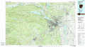 |
Brinkley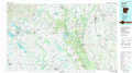 |
Helena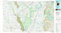 |
Malvern |
De Witt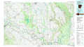 |
Clarksdale |
Camden |
Dumas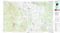 |
Greenwood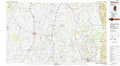 |
> Back to 34090a1 at 1:250,000 scale
> Back to U.S. Topo Maps home
1:24,000 Topo Quads covered by the spatial extent of this 100k map (De Witt)
|
Sherrill 
|
Gethsemane 
|
Humphrey 
|
Stuttgart South 
|
Almyra 
|
De Witt Ne 
|
Crocketts Bluff 
|
Turner 
|
|
Rob Roy 
|
Altheimer 
|
Humphrey Sw 
|
Lodge Corner 
|
De Witt Sw 
|
De Witt 
|
Ethel 
|
Indian Bay Se 
|
|
Ladd 
|
Moscow 
|
Cornerstone 
|
Reydell 
|
One Horse Store 
|
Tichnor 
|
Weber 
|
Henrico Ne 
|
|
Pinebergen 
|
Tarry 
|
Grady 
|
Cades 
|
Gillett 
|
Arkansas Post 
|
Henrico Sw 
|
Snow Lake 
|
