Alamo Lake Topo Map Arizona
To zoom in, hover over the map of Alamo Lake
USGS Topo Map 34113a1 - 1:100,000 scale
| Topo Map Name: | Alamo Lake |
| USGS Topo Quad ID: | 34113a1 |
| Print Size: | ca. 39" wide x 24" high |
| Southeast Coordinates: | 34° N latitude / 113° W longitude |
| Map Center Coordinates: | 34.25° N latitude / 113.5° W longitude |
| U.S. State: | AZ |
| Filename: | 34113a1.jpg |
| Download Map JPG Image: | Alamo Lake topo map 1:100,000 scale |
| Map Type: | Topographic |
| Topo Series: | 30´x60´ |
| Map Scale: | 1:100,000 |
| Source of Map Images: | United States Geological Survey (USGS) |
| Alternate Map Versions: |
Alamo Lake AZ 1979, updated 1997 Download PDF Buy paper map Alamo Lake AZ 1979, updated 1997 Download PDF Buy paper map |
1:100,000 Topos surrounding Alamo Lake
Needles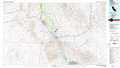 |
Bagdad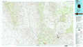 |
Prescott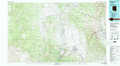 |
Parker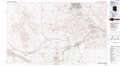 |
Alamo Lake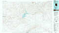 |
Bradshaw Mountains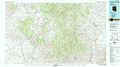 |
Blythe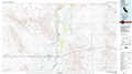 |
Salome |
Phoenix North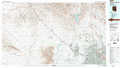 |
> Back to 34112a1 at 1:250,000 scale
> Back to U.S. Topo Maps home
1:24,000 Topo Quads covered by the spatial extent of this 100k map (Alamo Lake)
|
Castaneda Hills 
|
Mccracken Peak 
|
Signal 
|
Signal Mountain 
|
Arrastra Mountain 
|
Arrastra Mountain Ne 
|
Thorn Peak 
|
Malpais Mesa Ne 
|
|
Castaneda Hills Sw 
|
Centennial Wash 
|
Rawhide Wash 
|
Artillery Peak 
|
Palmerita Ranch 
|
Arrastra Mountain Se 
|
Ives Peak 
|
Malpais Mesa 
|
|
Planet 
|
Swansea 
|
Reid Valley 
|
Alamo Dam 
|
Smith Peak Nw 
|
Smith Peak Ne 
|
Date Creek Ranch Nw 
|
Date Creek Ranch 
|
|
Powerline Well 
|
Butler Pass 
|
Butler Well 
|
Alamo Dam Se 
|
E C P Peak 
|
Smith Peak 
|
Date Creek Ranch Sw 
|
Date Creek Ranch Se 
|
