Newberry Springs Topo Map California
To zoom in, hover over the map of Newberry Springs
USGS Topo Map 34116e1 - 1:100,000 scale
| Topo Map Name: | Newberry Springs |
| USGS Topo Quad ID: | 34116e1 |
| Print Size: | ca. 39" wide x 24" high |
| Southeast Coordinates: | 34.5° N latitude / 116° W longitude |
| Map Center Coordinates: | 34.75° N latitude / 116.5° W longitude |
| U.S. State: | CA |
| Filename: | 34116e1.jpg |
| Download Map JPG Image: | Newberry Springs topo map 1:100,000 scale |
| Map Type: | Topographic |
| Topo Series: | 30´x60´ |
| Map Scale: | 1:100,000 |
| Source of Map Images: | United States Geological Survey (USGS) |
| Alternate Map Versions: |
Newberry Springs CA 1977, updated 1993 Download PDF Buy paper map |
1:100,000 Topos surrounding Newberry Springs
Cuddeback Lake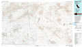 |
Soda Mountains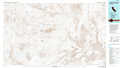 |
Ivanpah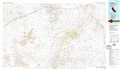 |
Victorville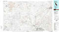 |
Newberry Springs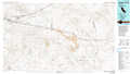 |
Amboy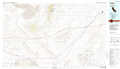 |
San Bernardino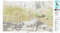 |
Big Bear Lake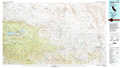 |
Sheep Hole Mountains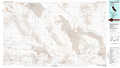 |
> Back to 34116a1 at 1:250,000 scale
> Back to U.S. Topo Maps home
1:24,000 Topo Quads covered by the spatial extent of this 100k map (Newberry Springs)
|
Nebo 
|
Yermo 
|
Harvard Hill 
|
Manix 
|
Hidden Valley West 
|
Hidden Valley East 
|
West Of Broadwell Mesa 
|
Broadwell Mesa 
|
|
Daggett 
|
Minneola 
|
Newberry Springs 
|
Troy Lake 
|
Hector 
|
Sleeping Beauty 
|
Broadwell Lake 
|
East Of Broadwell Lake 
|
|
West Ord Mountain 
|
Ord Mountain 
|
Camp Rock Mine 
|
Silver Bell Mine 
|
Sunshine Peak 
|
Lavic Lake 
|
Ludlow 
|
Ash Hill 
|
|
White Horse Mountain 
|
Grand View Mine 
|
Fry Mountains 
|
Iron Ridge 
|
Galway Lake 
|
Lavic Se 
|
Morgans Well 
|
Ludlow Se 
|
