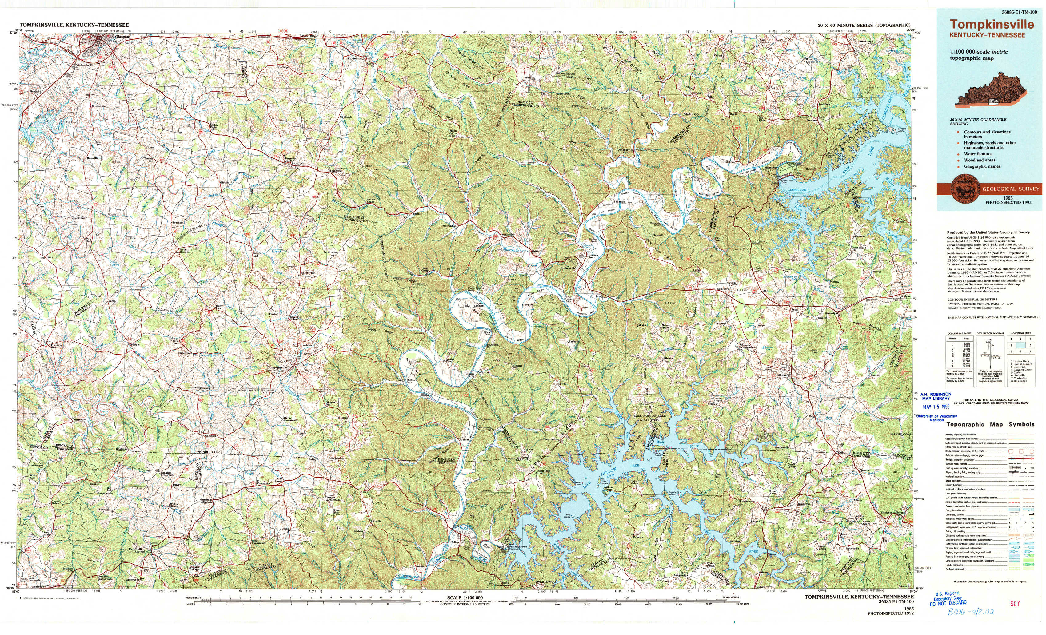
Tompkinsville Topo Map Kentucky
To zoom in, hover over the map of Tompkinsville
USGS Topo Map 36085e1 - 1:100,000 scale
| Topo Map Name: | Tompkinsville |
| USGS Topo Quad ID: | 36085e1 |
| Print Size: | ca. 39" wide x 24" high |
| Southeast Coordinates: | 36.5° N latitude / 85° W longitude |
| Map Center Coordinates: | 36.75° N latitude / 85.5° W longitude |
| U.S. States: | KY, TN |
| Filename: | 36085e1.jpg |
| Download Map JPG Image: | Tompkinsville topo map 1:100,000 scale |
| Map Type: | Topographic |
| Topo Series: | 30´x60´ |
| Map Scale: | 1:100,000 |
| Source of Map Images: | United States Geological Survey (USGS) |
| Alternate Map Versions: |
Tompkinsville KY 1985, updated 1986 Download PDF Buy paper map Tompkinsville KY 1985, updated 1994 Download PDF Buy paper map |
1:100,000 Topos surrounding Tompkinsville
Beaver Dam |
Campbellsville |
Somerset |
Bowling Green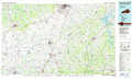 |
Tompkinsville |
Corbin |
Nashville |
Cookeville |
Oak Ridge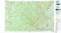 |
> Back to 36084a1 at 1:250,000 scale
> Back to U.S. Topo Maps home
1:24,000 Topo Quads covered by the spatial extent of this 100k map (Tompkinsville)
|
Glasgow South 
|
Temple Hill 
|
Summer Shade 
|
Edmonton 
|
Breeding 
|
Amandaville 
|
Creelsboro 
|
Jamestown 
|
|
Tracy 
|
Freedom 
|
Sulphur Lick 
|
Dubre 
|
Waterview 
|
Burkesville 
|
Wolf Creek Dam 
|
Cumberland City 
|
|
Fountain Run 
|
Gamaliel 
|
Tompkinsville 
|
Vernon 
|
Blacks Ferry 
|
Frogue 
|
Albany 
|
Savage 
|
|
Galen 
|
Red Boiling Springs 
|
Union Hill 
|
Celina 
|
Dale Hollow Dam 
|
Dale Hollow Reservoir Se 
|
Byrdstown 
|
Moodyville 
|