Dickson Topo Map Tennessee
To zoom in, hover over the map of Dickson
USGS Topo Map 36087a1 - 1:100,000 scale
| Topo Map Name: | Dickson |
| USGS Topo Quad ID: | 36087a1 |
| Print Size: | ca. 39" wide x 24" high |
| Southeast Coordinates: | 36° N latitude / 87° W longitude |
| Map Center Coordinates: | 36.25° N latitude / 87.5° W longitude |
| U.S. State: | TN |
| Filename: | 36087a1.jpg |
| Download Map JPG Image: | Dickson topo map 1:100,000 scale |
| Map Type: | Topographic |
| Topo Series: | 30´x60´ |
| Map Scale: | 1:100,000 |
| Source of Map Images: | United States Geological Survey (USGS) |
| Alternate Map Versions: |
Dickson TN 1985, updated 1985 Download PDF Buy paper map |
1:100,000 Topos surrounding Dickson
Murray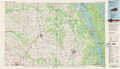 |
Hopkinsville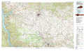 |
Bowling Green |
Mc Kenzie |
Dickson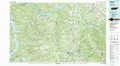 |
Nashville |
Milan |
Hohenwald |
Murfreesboro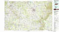 |
> Back to 36086a1 at 1:250,000 scale
> Back to U.S. Topo Maps home
1:24,000 Topo Quads covered by the spatial extent of this 100k map (Dickson)
|
Standing Rock 
|
Dover 
|
Cumberland City 
|
Needmore 
|
Palmyra 
|
Excell 
|
Henrietta 
|
Pleasant View 
|
|
Mckinnon 
|
Stewart 
|
Erin 
|
Ellis Mills 
|
Slayden 
|
Cumberland Furnace 
|
Cheatham Dam 
|
Ashland City 
|
|
Harmon Creek 
|
Halls Creek 
|
Woolworth 
|
Ruskin 
|
Vanleer 
|
Charlotte 
|
Harpeth Valley 
|
Lillamay 
|
|
Johnsonville 
|
Waverly 
|
Mcewen 
|
Tennessee City 
|
Dickson 
|
Burns 
|
White Bluff 
|
Kingston Springs 
|
