Raton Topo Map New Mexico
To zoom in, hover over the map of Raton
USGS Topo Map 36104e1 - 1:100,000 scale
| Topo Map Name: | Raton |
| USGS Topo Quad ID: | 36104e1 |
| Print Size: | ca. 39" wide x 24" high |
| Southeast Coordinates: | 36.5° N latitude / 104° W longitude |
| Map Center Coordinates: | 36.75° N latitude / 104.5° W longitude |
| U.S. States: | NM, CO |
| Filename: | 36104e1.jpg |
| Download Map JPG Image: | Raton topo map 1:100,000 scale |
| Map Type: | Topographic |
| Topo Series: | 30´x60´ |
| Map Scale: | 1:100,000 |
| Source of Map Images: | United States Geological Survey (USGS) |
| Alternate Map Versions: |
Raton NM 1981, updated 1981 Download PDF Buy paper map |
1:100,000 Topos surrounding Raton
Alamosa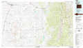 |
Trinidad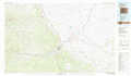 |
Kim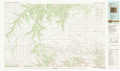 |
Wheeler Peak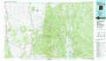 |
Raton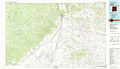 |
Capulin Mountain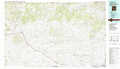 |
Taos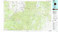 |
Springer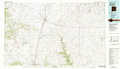 |
Clayton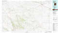 |
> Back to 36104a1 at 1:250,000 scale
> Back to U.S. Topo Maps home
1:24,000 Topo Quads covered by the spatial extent of this 100k map (Raton)
|
Casa Grande 
|
Caliente Canyon North 
|
Mcwilliams Canyon 
|
Tin Pan Canyon 
|
Raton 
|
Yankee 
|
Dale Mountain 
|
Trinchera Pass 
|
|
Casa Grande Sw 
|
Caliente Canyon South 
|
Curtis Camp 
|
Red River Peak 
|
Clifton House 
|
Hunter Mesa 
|
Johnson Park 
|
Robinson Peak 
|
|
House Canyon 
|
Dawson 
|
Saltpeter Mountain 
|
Koehler 
|
Eagle Tail Mountain 
|
Tinaja Mountain 
|
Mesa Larga 
|
Kiowa 
|
|
Cimarron 
|
Cimarron Se 
|
Colfax 
|
Maxwell 
|
Loco Arroyo 
|
Tres Hermanos Peak 
|
Pine Buttes 
|
Palo Blanco Mountain 
|
