Del Norte Topo Map Colorado
To zoom in, hover over the map of Del Norte
USGS Topo Map 37106e1 - 1:100,000 scale
| Topo Map Name: | Del Norte |
| USGS Topo Quad ID: | 37106e1 |
| Print Size: | ca. 39" wide x 24" high |
| Southeast Coordinates: | 37.5° N latitude / 106° W longitude |
| Map Center Coordinates: | 37.75° N latitude / 106.5° W longitude |
| U.S. State: | CO |
| Filename: | 37106e1.jpg |
| Download Map JPG Image: | Del Norte topo map 1:100,000 scale |
| Map Type: | Topographic |
| Topo Series: | 30´x60´ |
| Map Scale: | 1:100,000 |
| Source of Map Images: | United States Geological Survey (USGS) |
| Alternate Map Versions: |
Del Norte CO 1982, updated 1983 Download PDF Buy paper map |
1:100,000 Topos surrounding Del Norte
Montrose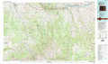 |
Saguache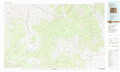 |
Canon City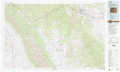 |
Silverton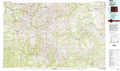 |
Del Norte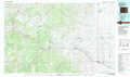 |
Blanca Peak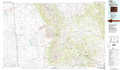 |
Durango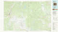 |
Antonito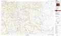 |
Alamosa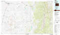 |
> Back to 37106a1 at 1:250,000 scale
> Back to U.S. Topo Maps home
1:24,000 Topo Quads covered by the spatial extent of this 100k map (Del Norte)
|
San Luis Peak 
|
Halfmoon Pass 
|
Mesa Mountain 
|
Bowers Peak 
|
Lookout Mountain 
|
Lime Creek 
|
Swede Corners 
|
Harrence Lake 
|
|
Creede 
|
Wagon Wheel Gap 
|
Pool Table Mountain 
|
Pine Cone Knob 
|
Twin Mountains 
|
Twin Mountains Se 
|
La Garita 
|
Center North 
|
|
Spar City 
|
Lake Humphreys 
|
South Fork West 
|
South Fork East 
|
Indian Head 
|
Del Norte 
|
Sevenmile Plaza 
|
Center South 
|
|
South River Creek 
|
Mount Hope 
|
Beaver Creek Reservoir 
|
Del Norte Peak 
|
Horseshoe Mountain 
|
Dog Mountain 
|
Monte Vista 
|
Homelake 
|
