Lexington Topo Map Kentucky
To zoom in, hover over the map of Lexington
USGS Topo Map 38084a1 - 1:100,000 scale
| Topo Map Name: | Lexington |
| USGS Topo Quad ID: | 38084a1 |
| Print Size: | ca. 39" wide x 24" high |
| Southeast Coordinates: | 38° N latitude / 84° W longitude |
| Map Center Coordinates: | 38.25° N latitude / 84.5° W longitude |
| U.S. State: | KY |
| Filename: | 38084a1.jpg |
| Download Map JPG Image: | Lexington topo map 1:100,000 scale |
| Map Type: | Topographic |
| Topo Series: | 30´x60´ |
| Map Scale: | 1:100,000 |
| Source of Map Images: | United States Geological Survey (USGS) |
| Alternate Map Versions: |
Lexington KY 1986, updated 1986 Download PDF Buy paper map |
1:100,000 Topos surrounding Lexington
Madison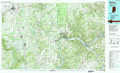 |
Falmouth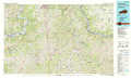 |
Maysville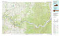 |
Louisville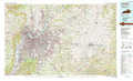 |
Lexington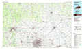 |
Morehead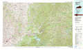 |
Elizabethtown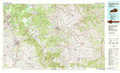 |
Harrodsburg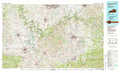 |
Irvine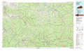 |
> Back to 38084a1 at 1:250,000 scale
> Back to U.S. Topo Maps home
1:24,000 Topo Quads covered by the spatial extent of this 100k map (Lexington)
|
Gratz 
|
Monterey 
|
New Columbus 
|
Sadieville 
|
Breckinridge 
|
Cynthiana 
|
Shady Nook 
|
Piqua 
|
|
Polsgrove 
|
Switzer 
|
Stamping Ground 
|
Delaplain 
|
Leesburg 
|
Shawhan 
|
Millersburg 
|
Carlisle 
|
|
Frankfort West 
|
Frankfort East 
|
Midway 
|
Georgetown 
|
Centerville 
|
Paris West 
|
Paris East 
|
North Middletown 
|
|
Lawrenceburg 
|
Tyrone 
|
Versailles 
|
Lexington West 
|
Lexington East 
|
Clintonville 
|
Austerlitz 
|
Sideview 
|
