Cheyenne Wells Topo Map Colorado
To zoom in, hover over the map of Cheyenne Wells
USGS Topo Map 38102e1 - 1:100,000 scale
| Topo Map Name: | Cheyenne Wells |
| USGS Topo Quad ID: | 38102e1 |
| Print Size: | ca. 39" wide x 24" high |
| Southeast Coordinates: | 38.5° N latitude / 102° W longitude |
| Map Center Coordinates: | 38.75° N latitude / 102.5° W longitude |
| U.S. States: | CO, KS |
| Filename: | 38102e1.jpg |
| Download Map JPG Image: | Cheyenne Wells topo map 1:100,000 scale |
| Map Type: | Topographic |
| Topo Series: | 30´x60´ |
| Map Scale: | 1:100,000 |
| Source of Map Images: | United States Geological Survey (USGS) |
| Alternate Map Versions: |
Cheyenne Wells CO 1981, updated 1982 Download PDF Buy paper map |
1:100,000 Topos surrounding Cheyenne Wells
Limon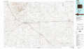 |
Burlington |
Goodland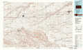 |
Karval |
Cheyenne Wells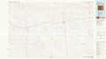 |
Sharon Springs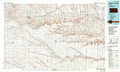 |
Las Animas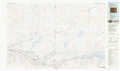 |
Lamar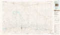 |
Leoti |
> Back to 38102a1 at 1:250,000 scale
> Back to U.S. Topo Maps home
1:24,000 Topo Quads covered by the spatial extent of this 100k map (Cheyenne Wells)
|
Kit Carson Nw 
|
Big Spring 
|
Eureka Creek North 
|
Landsman Hill 
|
Cheyenne Wells Nw 
|
Cheyenne Wells Ne 
|
Arapahoe Nw 
|
Arapahoe Ne 
|
|
Sorrento 
|
Kit Carson 
|
Eureka Creek South 
|
Firstview 
|
Cheyenne Wells Sw 
|
Cheyenne Wells 
|
Arapahoe 
|
Arapahoe Se 
|
|
Arsenic Lake 
|
Lewis Lake 
|
Kit Carson 4 Nw 
|
Kit Carson 4 Ne 
|
Cheyenne Wells 3 Nw 
|
Cheyenne Wells 3 Ne 
|
Lake Albert Nw 
|
Cheyenne Wells 4 Ne 
|
|
Arsenic Lake Sw 
|
Dunlap Ranch 
|
Oswald Ranch 
|
Kit Carson 4 Se 
|
Cheyenne Wells 3 Sw 
|
Cheyenne Wells 3 Se 
|
Lake Albert 
|
Cheyenne Wells 4 Se 
|
