Canon City Topo Map Colorado
To zoom in, hover over the map of Canon City
USGS Topo Map 38105a1 - 1:100,000 scale
| Topo Map Name: | Canon City |
| USGS Topo Quad ID: | 38105a1 |
| Print Size: | ca. 39" wide x 24" high |
| Southeast Coordinates: | 38° N latitude / 105° W longitude |
| Map Center Coordinates: | 38.25° N latitude / 105.5° W longitude |
| U.S. State: | CO |
| Filename: | 38105a1.jpg |
| Download Map JPG Image: | Canon City topo map 1:100,000 scale |
| Map Type: | Topographic |
| Topo Series: | 30´x60´ |
| Map Scale: | 1:100,000 |
| Source of Map Images: | United States Geological Survey (USGS) |
| Alternate Map Versions: |
Canon City CO 1982, updated 1983 Download PDF Buy paper map |
1:100,000 Topos surrounding Canon City
Gunnison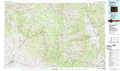 |
Pikes Peak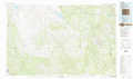 |
Colorado Springs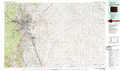 |
Saguache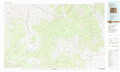 |
Canon City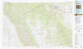 |
Pueblo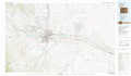 |
Del Norte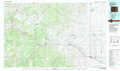 |
Blanca Peak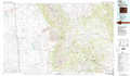 |
Walsenburg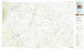 |
> Back to 38104a1 at 1:250,000 scale
> Back to U.S. Topo Maps home
1:24,000 Topo Quads covered by the spatial extent of this 100k map (Canon City)
|
Wellsville 
|
Howard 
|
Arkansas Mountain 
|
Echo 
|
Mcintyre Hills 
|
Royal Gorge 
|
Canon City 
|
Florence 
|
|
Bushnell Peak 
|
Coaldale 
|
Cotopaxi 
|
Hillside 
|
Iron Mountain 
|
Curley Peak 
|
Rockvale 
|
Florence Se 
|
|
Villa Grove 
|
Valley View Hot Springs 
|
Electric Peak 
|
Beckwith Mountain 
|
Westcliffe 
|
Mount Tyndall 
|
Hardscrabble Mountain 
|
Wetmore 
|
|
Moffat North 
|
Mirage 
|
Rito Alto Peak 
|
Horn Peak 
|
Aldrich Gulch 
|
Rosita 
|
Deer Peak 
|
Saint Charles Peak 
|
