Mexico Topo Map Missouri
To zoom in, hover over the map of Mexico
USGS Topo Map 39091a1 - 1:100,000 scale
| Topo Map Name: | Mexico |
| USGS Topo Quad ID: | 39091a1 |
| Print Size: | ca. 39" wide x 24" high |
| Southeast Coordinates: | 39° N latitude / 91° W longitude |
| Map Center Coordinates: | 39.25° N latitude / 91.5° W longitude |
| U.S. States: | MO, IL |
| Filename: | 39091a1.jpg |
| Download Map JPG Image: | Mexico topo map 1:100,000 scale |
| Map Type: | Topographic |
| Topo Series: | 30´x60´ |
| Map Scale: | 1:100,000 |
| Source of Map Images: | United States Geological Survey (USGS) |
| Alternate Map Versions: |
Mexico MO 1986, updated 1986 Download PDF Buy paper map Mexico MO 1986, updated 1990 Download PDF Buy paper map |
1:100,000 Topos surrounding Mexico
Macon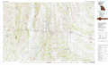 |
Quincy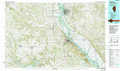 |
Meredosia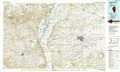 |
Moberly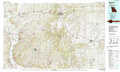 |
Mexico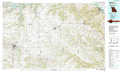 |
Jerseyville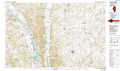 |
Jefferson City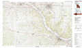 |
Fulton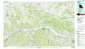 |
Saint Louis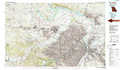 |
> Back to 39090a1 at 1:250,000 scale
> Back to U.S. Topo Maps home
1:24,000 Topo Quads covered by the spatial extent of this 100k map (Mexico)
|
Paris East 
|
Florida 
|
Perry 
|
Perry Ne 
|
Spencerburg 
|
Frankford 
|
Vera 
|
Louisana 
|
|
Molino 
|
Sante Fe 
|
Hutchison 
|
Farber 
|
Vandalia 
|
Curryville 
|
Bowling Green 
|
Cyrene 
|
|
Mexico West 
|
Mexico East 
|
Laddonia 
|
Vandalia Lake 
|
Middletown 
|
New Hartford 
|
Louisville 
|
Eolia 
|
|
Auxvasse 
|
Mexico Se 
|
Martinsburg 
|
Wellsville 
|
Buell 
|
Bellflower North 
|
Truxton 
|
Silex 
|
