Mount Ayr Topo Map Iowa
To zoom in, hover over the map of Mount Ayr
USGS Topo Map 40094e1 - 1:100,000 scale
| Topo Map Name: | Mount Ayr |
| USGS Topo Quad ID: | 40094e1 |
| Print Size: | ca. 39" wide x 24" high |
| Southeast Coordinates: | 40.5° N latitude / 94° W longitude |
| Map Center Coordinates: | 40.75° N latitude / 94.5° W longitude |
| U.S. States: | IA, MO |
| Filename: | 40094e1.jpg |
| Download Map JPG Image: | Mount Ayr topo map 1:100,000 scale |
| Map Type: | Topographic |
| Topo Series: | 30´x60´ |
| Map Scale: | 1:100,000 |
| Source of Map Images: | United States Geological Survey (USGS) |
| Alternate Map Versions: |
Mount Ayr IA 1985, updated 1985 Download PDF Buy paper map |
1:100,000 Topos surrounding Mount Ayr
Omaha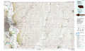 |
Creston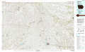 |
Indianola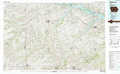 |
Nebraska City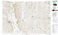 |
Mount Ayr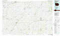 |
Leon |
Falls City |
Maryville |
Trenton |
> Back to 40094a1 at 1:250,000 scale
> Back to U.S. Topo Maps home
1:24,000 Topo Quads covered by the spatial extent of this 100k map (Mount Ayr)
|
Villisca 
|
Brooks 
|
Corning South 
|
Lenox 
|
Kent 
|
Shannon City 
|
Arispe 
|
Tingley Ne 
|
|
Hawleyville 
|
Guss 
|
Gravity 
|
Merle Junction 
|
Clearfield 
|
Diagonal 
|
Tingley 
|
Ellston 
|
|
New Market 
|
Ladoga 
|
Bedford 
|
Conway 
|
Maloy 
|
Benton 
|
Mount Ayr 
|
Kellerton 
|
|
Hopkins Sw 
|
Hopkins 
|
Bedford Sw 
|
Sheridan 
|
Blockton 
|
Blockton Se 
|
Hatfield 
|
Pawnee 
|
