Kings Peak Topo Map Utah
To zoom in, hover over the map of Kings Peak
USGS Topo Map 40110e1 - 1:100,000 scale
| Topo Map Name: | Kings Peak |
| USGS Topo Quad ID: | 40110e1 |
| Print Size: | ca. 39" wide x 24" high |
| Southeast Coordinates: | 40.5° N latitude / 110° W longitude |
| Map Center Coordinates: | 40.75° N latitude / 110.5° W longitude |
| U.S. States: | UT, WY |
| Filename: | 40110e1.jpg |
| Download Map JPG Image: | Kings Peak topo map 1:100,000 scale |
| Map Type: | Topographic |
| Topo Series: | 30´x60´ |
| Map Scale: | 1:100,000 |
| Source of Map Images: | United States Geological Survey (USGS) |
| Alternate Map Versions: |
Kings Peak UT 1982, updated 1985 Download PDF Buy paper map Kings Peak UT 1982, updated 1985 Download PDF Buy paper map |
1:100,000 Topos surrounding Kings Peak
Ogden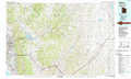 |
Evanston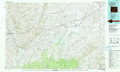 |
Firehole Canyon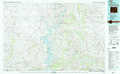 |
Salt Lake City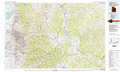 |
Kings Peak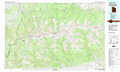 |
Dutch John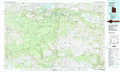 |
Provo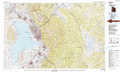 |
Duchesne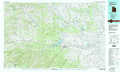 |
Vernal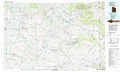 |
> Back to 40110a1 at 1:250,000 scale
> Back to U.S. Topo Maps home
1:24,000 Topo Quads covered by the spatial extent of this 100k map (Kings Peak)
|
Seven Tree Flat 
|
Deadman Mountain 
|
Elizabeth Mountain 
|
Lyman Lake 
|
Bridger Lake 
|
Gilbert Peak Ne 
|
Hole In The Rock 
|
Hoop Lake 
|
|
Whitney Reservoir 
|
Christmas Meadows 
|
Red Knob 
|
Mount Lovenia 
|
Mount Powell 
|
Kings Peak 
|
Fox Lake 
|
Chepeta Lake 
|
|
Mirror Lake 
|
Hayden Peak 
|
Explorer Peak 
|
Oweep Creek 
|
Garfield Basin 
|
Mount Emmons 
|
Bollie Lake 
|
Rasmussen Lakes 
|
|
Iron Mine Mountain 
|
Grandaddy Lake 
|
Tworoose Pass 
|
Kidney Lake 
|
Lake Fork Mountain 
|
Burnt Mill Spring 
|
Heller Lake 
|
Pole Creek Cave 
|
