Currie Topo Map Nevada
To zoom in, hover over the map of Currie
USGS Topo Map 40114a1 - 1:100,000 scale
| Topo Map Name: | Currie |
| USGS Topo Quad ID: | 40114a1 |
| Print Size: | ca. 39" wide x 24" high |
| Southeast Coordinates: | 40° N latitude / 114° W longitude |
| Map Center Coordinates: | 40.25° N latitude / 114.5° W longitude |
| U.S. States: | NV, UT |
| Filename: | 40114a1.jpg |
| Download Map JPG Image: | Currie topo map 1:100,000 scale |
| Map Type: | Topographic |
| Topo Series: | 30´x60´ |
| Map Scale: | 1:100,000 |
| Source of Map Images: | United States Geological Survey (USGS) |
| Alternate Map Versions: |
Currie NV 1987, updated 1987 Download PDF Buy paper map |
1:100,000 Topos surrounding Currie
Elko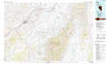 |
Wendover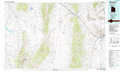 |
Bonneville Salt Flats |
Ruby Lake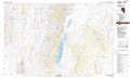 |
Currie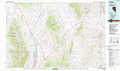 |
Wildcat Mountain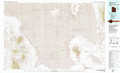 |
Newark Lake |
Kern Mountains |
Fish Springs |
> Back to 40114a1 at 1:250,000 scale
> Back to U.S. Topo Maps home
1:24,000 Topo Quads covered by the spatial extent of this 100k map (Currie)
|
Palomino Well 
|
Palomino Ridge 
|
Mizpah 
|
Mizpah Point 
|
White Horse Mountain Nw 
|
Goshute Peak 
|
Ferguson Mountain 
|
Ferguson Flat 
|
|
Silo Canyon 
|
Currie Gardens 
|
Currie 
|
Sharp Peak 
|
Dolly Varden Spring 
|
White Horse Mountain 
|
White Horse Pass 
|
Utah Peak 
|
|
Mount Taylor 
|
Mcdermid Ranch 
|
Goshute Lake North 
|
Goshute Lake Ne 
|
Boone Canyon 
|
Kinsley Mountain 
|
Ferber Peak Nw 
|
Ferber Peak 
|
|
Paris Creek 
|
Goshute Creek 
|
Goshute Lake South 
|
Lages Station 
|
Chin Creek Spring 
|
Chin Creek Reservoir 
|
Ayarbe Spring 
|
Ferber Peak Se 
|
