Garberville Topo Map California
To zoom in, hover over the map of Garberville
USGS Topo Map 40123a1 - 1:100,000 scale
| Topo Map Name: | Garberville |
| USGS Topo Quad ID: | 40123a1 |
| Print Size: | ca. 39" wide x 24" high |
| Southeast Coordinates: | 40° N latitude / 123° W longitude |
| Map Center Coordinates: | 40.25° N latitude / 123.5° W longitude |
| U.S. State: | CA |
| Filename: | 40123a1.jpg |
| Download Map JPG Image: | Garberville topo map 1:100,000 scale |
| Map Type: | Topographic |
| Topo Series: | 30´x60´ |
| Map Scale: | 1:100,000 |
| Source of Map Images: | United States Geological Survey (USGS) |
| Alternate Map Versions: |
Garberville CA 1979, updated 1996 Download PDF Buy paper map |
1:100,000 Topos surrounding Garberville
Eureka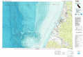 |
Hayfork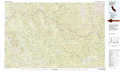 |
Redding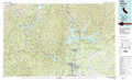 |
Cape Mendocino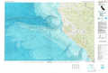 |
Garberville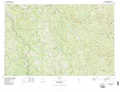 |
Red Bluff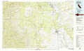 |
West Of Covelo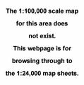 |
Covelo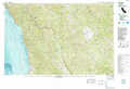 |
Willows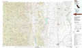 |
> Back to 40122a1 at 1:250,000 scale
> Back to U.S. Topo Maps home
1:24,000 Topo Quads covered by the spatial extent of this 100k map (Garberville)
|
Redcrest 
|
Bridgeville 
|
Larabee Valley 
|
Dinsmore 
|
Sportshaven 
|
Naufus Creek 
|
Wildwood 
|
|
|
Weott 
|
Myers Flat 
|
Blocksburg 
|
Black Lassic 
|
Ruth Lake 
|
Forest Glen 
|
Pony Buck Peak 
|
|
|
Ettersburg 
|
Miranda 
|
Fort Seward 
|
Alderpoint 
|
Zenia 
|
Shannon Butte 
|
Black Rock Mountain 
|
|
|
Briceland 
|
Garberville 
|
Harris 
|
Jewett Rock 
|
Lake Mountain 
|
Long Ridge 
|
Wrights Ridge 
|
