Evanston Topo Map Wyoming
To zoom in, hover over the map of Evanston
USGS Topo Map 41110a1 - 1:100,000 scale
| Topo Map Name: | Evanston |
| USGS Topo Quad ID: | 41110a1 |
| Print Size: | ca. 39" wide x 24" high |
| Southeast Coordinates: | 41° N latitude / 110° W longitude |
| Map Center Coordinates: | 41.25° N latitude / 110.5° W longitude |
| U.S. State: | WY |
| Filename: | 41110a1.jpg |
| Download Map JPG Image: | Evanston topo map 1:100,000 scale |
| Map Type: | Topographic |
| Topo Series: | 30´x60´ |
| Map Scale: | 1:100,000 |
| Source of Map Images: | United States Geological Survey (USGS) |
| Alternate Map Versions: |
Evanston WY 1980, updated 1992 Download PDF Buy paper map |
1:100,000 Topos surrounding Evanston
Logan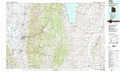 |
Kemmerer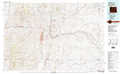 |
Rock Springs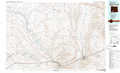 |
Ogden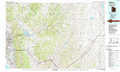 |
Evanston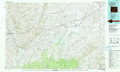 |
Firehole Canyon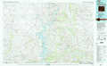 |
Salt Lake City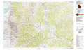 |
Kings Peak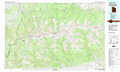 |
Dutch John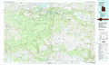 |
> Back to 41110a1 at 1:250,000 scale
> Back to U.S. Topo Maps home
1:24,000 Topo Quads covered by the spatial extent of this 100k map (Evanston)
|
Three Forks 
|
Little Dee Creek 
|
Meadow Draw 
|
Bridger 
|
Carter 
|
Austin Reservoir 
|
Millersville 
|
Wildcat Butte 
|
|
Evanston 
|
Guild Hollow 
|
Ragan 
|
Leroy 
|
Fort Bridger 
|
Mountain View 
|
Turtle Hill 
|
Butcher Knife Draw 
|
|
Millis 
|
Sulphur Creek Reservoir 
|
Piedmont Reservoir 
|
Hague Creek 
|
Robertson 
|
Leavitt Bench 
|
Reed Reservoir 
|
Soap Holes Reservoir 
|
|
Myers Reservoir 
|
Pine Knoll 
|
Moslander Reservoir 
|
Meeks Cabin Reservoir 
|
Buck Fever Ridge 
|
Table Mountain 
|
Lonetree 
|
Burntfork 
|
