Flint Topo Map Michigan
To zoom in, hover over the map of Flint
USGS Topo Map 43083a1 - 1:100,000 scale
| Topo Map Name: | Flint |
| USGS Topo Quad ID: | 43083a1 |
| Print Size: | ca. 39" wide x 24" high |
| Southeast Coordinates: | 43° N latitude / 83° W longitude |
| Map Center Coordinates: | 43.25° N latitude / 83.5° W longitude |
| U.S. State: | MI |
| Filename: | 43083a1.jpg |
| Download Map JPG Image: | Flint topo map 1:100,000 scale |
| Map Type: | Topographic |
| Topo Series: | 30´x60´ |
| Map Scale: | 1:100,000 |
| Source of Map Images: | United States Geological Survey (USGS) |
| Alternate Map Versions: |
Flint MI 1984, updated 1985 Download PDF Buy paper map Flint MI 1990, updated 1991 Download PDF Buy paper map |
1:100,000 Topos surrounding Flint
Midland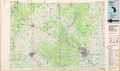 |
Bay City |
Harbor Beach |
Alma |
Flint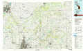 |
Croswell |
Lansing |
Pontiac |
Lake Saint Clair North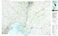 |
> Back to 43082a1 at 1:250,000 scale
> Back to U.S. Topo Maps home
1:24,000 Topo Quads covered by the spatial extent of this 100k map (Flint)
|
Saginaw 
|
Saginaw Ne 
|
Reese 
|
Gilford 
|
Caro 
|
East Dayton 
|
Kingston 
|
Decker 
|
|
Bridgeport 
|
Birch Run North 
|
Frankenmuth 
|
Vassar 
|
Juniata 
|
Mayville 
|
Clifford 
|
Marlette 
|
|
Montrose 
|
Birch Run South 
|
Clio 
|
Otisville 
|
Columbiaville 
|
Barnes Lake 
|
North Branch 
|
Burnside 
|
|
New Lothrop 
|
Flushing 
|
Flint North 
|
Davison 
|
Elba 
|
Lapeer 
|
Attica 
|
Imlay City 
|
