Fond Du Lac Topo Map Wisconsin
To zoom in, hover over the map of Fond Du Lac
USGS Topo Map 43088e1 - 1:100,000 scale
| Topo Map Name: | Fond Du Lac |
| USGS Topo Quad ID: | 43088e1 |
| Print Size: | ca. 39" wide x 24" high |
| Southeast Coordinates: | 43.5° N latitude / 88° W longitude |
| Map Center Coordinates: | 43.75° N latitude / 88.5° W longitude |
| U.S. State: | WI |
| Filename: | 43088e1.jpg |
| Download Map JPG Image: | Fond Du Lac topo map 1:100,000 scale |
| Map Type: | Topographic |
| Topo Series: | 30´x60´ |
| Map Scale: | 1:100,000 |
| Source of Map Images: | United States Geological Survey (USGS) |
| Alternate Map Versions: |
Fond Du Lac WI 1980, updated 1980 Download PDF Buy paper map |
1:100,000 Topos surrounding Fond Du Lac
Wisconsin Rapids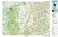 |
Appleton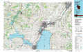 |
Manitowoc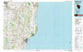 |
Wisconsin Dells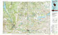 |
Fond Du Lac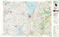 |
Sheboygan |
Madison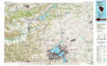 |
Oconomowoc |
Milwaukee |
> Back to 43088a1 at 1:250,000 scale
> Back to U.S. Topo Maps home
1:24,000 Topo Quads covered by the spatial extent of this 100k map (Fond Du Lac)
|
Berlin 
|
Rush Lake 
|
Pickett 
|
Van Dyne 
|
Fahrney Point 
|
Brothertown 
|
Marytown 
|
Kiel 
|
|
Green Lake 
|
Ripon 
|
Rosendale 
|
Eldorado 
|
Fond Du Lac 
|
Saint Peter 
|
Saint Cloud 
|
Elkhart Lake 
|
|
Markesan 
|
Brandon 
|
Waupun North 
|
Oakfield 
|
Byron 
|
Eden 
|
Dundee 
|
Cascade 
|
|
Fox Lake 
|
Buckhorn Corner 
|
Waupun South 
|
Mayville North 
|
Lomira 
|
Campbellsport 
|
Kewaskum 
|
Batavia 
|
