Charles City Topo Map Iowa
To zoom in, hover over the map of Charles City
USGS Topo Map 43092a1 - 1:100,000 scale
| Topo Map Name: | Charles City |
| USGS Topo Quad ID: | 43092a1 |
| Print Size: | ca. 39" wide x 24" high |
| Southeast Coordinates: | 43° N latitude / 92° W longitude |
| Map Center Coordinates: | 43.25° N latitude / 92.5° W longitude |
| U.S. States: | IA, MN |
| Filename: | 43092a1.jpg |
| Download Map JPG Image: | Charles City topo map 1:100,000 scale |
| Map Type: | Topographic |
| Topo Series: | 30´x60´ |
| Map Scale: | 1:100,000 |
| Source of Map Images: | United States Geological Survey (USGS) |
| Alternate Map Versions: |
Charles City IA 1985, updated 1985 Download PDF Buy paper map Charles City IA 1985, updated 1990 Download PDF Buy paper map |
1:100,000 Topos surrounding Charles City
Albert Lea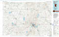 |
Austin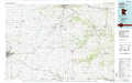 |
La Crosse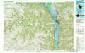 |
Mason City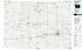 |
Charles City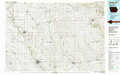 |
Decorah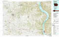 |
Iowa Falls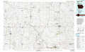 |
Waverly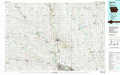 |
Oelwein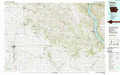 |
> Back to 43092a1 at 1:250,000 scale
> Back to U.S. Topo Maps home
1:24,000 Topo Quads covered by the spatial extent of this 100k map (Charles City)
|
Saint Ansgar 
|
Stacyville 
|
Little Cedar 
|
Mcintire 
|
Lime Springs Nw 
|
Lime Springs 
|
Cresco Nw 
|
Cresco Ne 
|
|
Osage Sw 
|
Osage 
|
New Haven 
|
Riceville 
|
Saratoga 
|
Lourdes 
|
Cresco Sw 
|
Cresco Se 
|
|
Rudd 
|
Orchard 
|
Floyd 
|
Colwell 
|
Elma 
|
Jerico 
|
Saude 
|
Protivin 
|
|
Rockford 
|
Roseville 
|
Charles City 
|
Bassett 
|
Ionia 
|
New Hampton 
|
Lawler 
|
Waucoma 
|
