Burns Topo Map Oregon
To zoom in, hover over the map of Burns
USGS Topo Map 43119e1 - 1:100,000 scale
| Topo Map Name: | Burns |
| USGS Topo Quad ID: | 43119e1 |
| Print Size: | ca. 39" wide x 24" high |
| Southeast Coordinates: | 43.5° N latitude / 119° W longitude |
| Map Center Coordinates: | 43.75° N latitude / 119.5° W longitude |
| U.S. State: | OR |
| Filename: | 43119e1.jpg |
| Download Map JPG Image: | Burns topo map 1:100,000 scale |
| Map Type: | Topographic |
| Topo Series: | 30´x60´ |
| Map Scale: | 1:100,000 |
| Source of Map Images: | United States Geological Survey (USGS) |
| Alternate Map Versions: |
Burns OR 1993, updated 1993 Download PDF Buy paper map |
1:100,000 Topos surrounding Burns
Prineville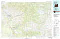 |
Dayville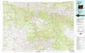 |
John Day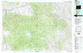 |
Brothers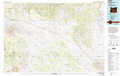 |
Burns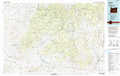 |
Stinkingwater Mountains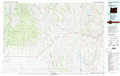 |
Christmas Valley |
Harney Lake |
Malheur Lake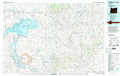 |
> Back to 43118a1 at 1:250,000 scale
> Back to U.S. Topo Maps home
1:24,000 Topo Quads covered by the spatial extent of this 100k map (Burns)
|
Hardin Ranch 
|
Twelvemile Reservoir 
|
Delintment Lake 
|
Big Mowich Mountain 
|
Whiskey Mountain 
|
Alsup Mountain 
|
West Myrtle Butte 
|
Myrtle Park Meadows 
|
|
Ibex Butte 
|
Mackey Butte 
|
Buck Spring 
|
Donnelly Butte 
|
Bear Canyon Butte 
|
Hughet Valley 
|
Landing Creek 
|
Mosquito Flat 
|
|
Dust Bowl 
|
Bulger Ridge 
|
Camp Currey Spring 
|
Dry Mountain 
|
Egypt Canyon 
|
Holmes Canyon 
|
Burns Ne 
|
Poison Creek 
|
|
Hat Butte 
|
Potato Hills 
|
Suntex 
|
Riley 
|
Oakerman Lakes 
|
Sage Hen Hill 
|
Burns Butte 
|
Burns 
|
