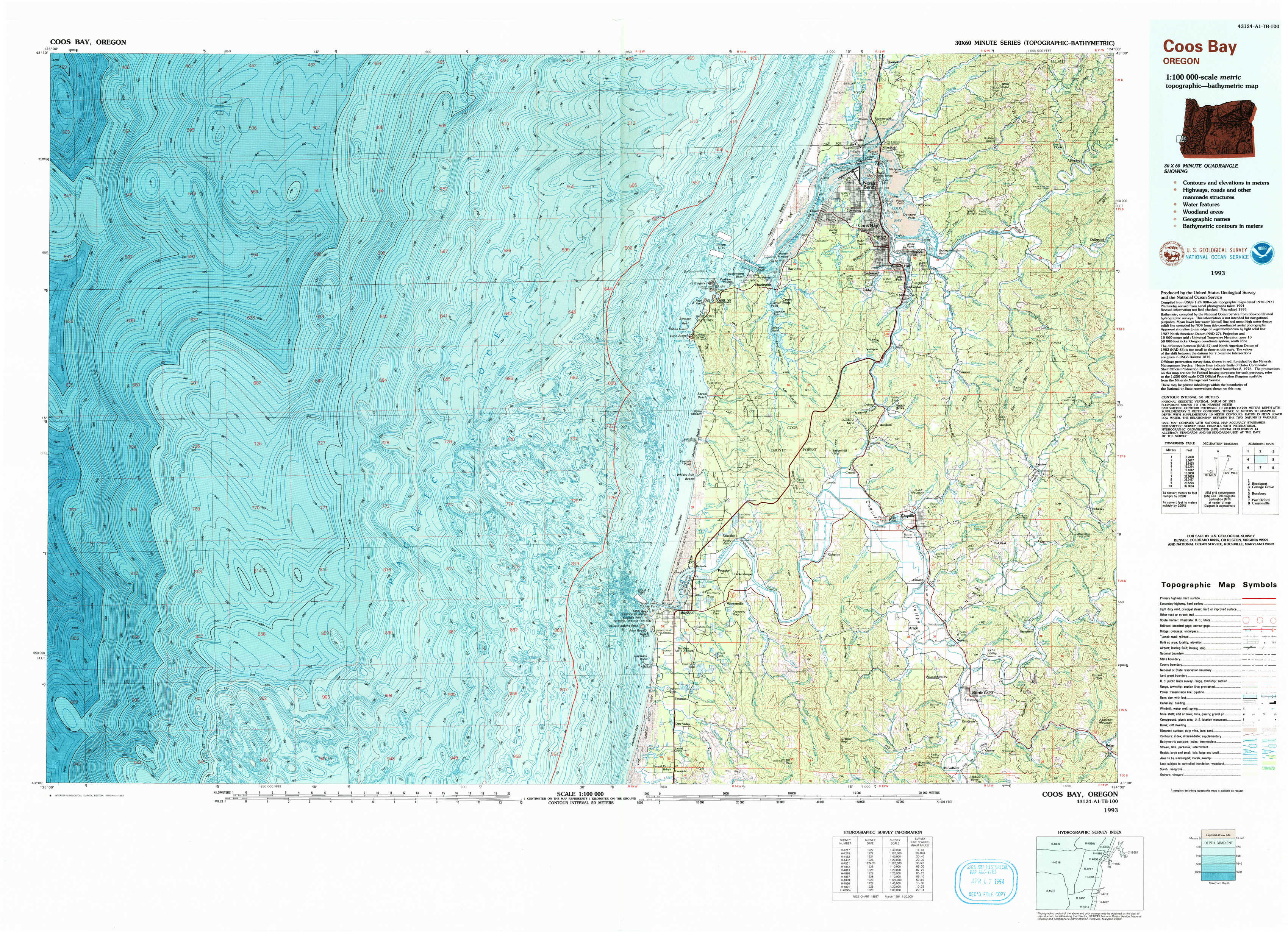
Coos Bay Topo Map Oregon
To zoom in, hover over the map of Coos Bay
USGS Topo Map 43124a1 - 1:100,000 scale
| Topo Map Name: | Coos Bay |
| USGS Topo Quad ID: | 43124a1 |
| Print Size: | ca. 39" wide x 24" high |
| Southeast Coordinates: | 43° N latitude / 124° W longitude |
| Map Center Coordinates: | 43.25° N latitude / 124.5° W longitude |
| U.S. State: | OR |
| Filename: | 43124a1.jpg |
| Download Map JPG Image: | Coos Bay topo map 1:100,000 scale |
| Map Type: | Topographic |
| Topo Series: | 30´x60´ |
| Map Scale: | 1:100,000 |
| Source of Map Images: | United States Geological Survey (USGS) |
| Alternate Map Versions: |
Coos Bay OR 1993, updated 1993 Download PDF Buy paper map |
1:100,000 Topos surrounding Coos Bay
Reedsport |
Cottage Grove |
|
Coos Bay |
Roseburg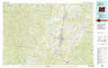 |
|
Port Orford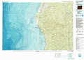 |
Canyonville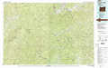 |
> Back to 43124a1 at 1:250,000 scale
> Back to U.S. Topo Maps home
1:24,000 Topo Quads covered by the spatial extent of this 100k map (Coos Bay)
|
Empire 
|
North Bend 
|
Allegany 
|
|||||
|
Cape Arago 
|
Charleston 
|
Coos Bay 
|
Daniels Creek 
|
Bullards 
|
Riverton 
|
||
|
Coquille 
|
Mckinley 
|
Bandon 
|
Bill Peak 
|
Myrtle Point 
|
Bridge 
|