Millinocket Topo Map Maine
To zoom in, hover over the map of Millinocket
USGS Topo Map 45068e1 - 1:100,000 scale
| Topo Map Name: | Millinocket |
| USGS Topo Quad ID: | 45068e1 |
| Print Size: | ca. 39" wide x 24" high |
| Southeast Coordinates: | 45.5° N latitude / 68° W longitude |
| Map Center Coordinates: | 45.75° N latitude / 68.5° W longitude |
| U.S. State: | ME |
| Filename: | 45068e1.jpg |
| Download Map JPG Image: | Millinocket topo map 1:100,000 scale |
| Map Type: | Topographic |
| Topo Series: | 30´x60´ |
| Map Scale: | 1:100,000 |
| Source of Map Images: | United States Geological Survey (USGS) |
| Alternate Map Versions: |
Millinocket ME 1985, updated 1986 Download PDF Buy paper map Millinocket ME 1985, updated 1994 Download PDF Buy paper map |
1:100,000 Topos surrounding Millinocket
Chamberlain Lake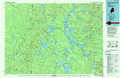 |
Oakfield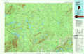 |
Houlton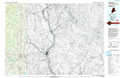 |
Moosehead Lake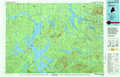 |
Millinocket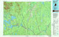 |
Danforth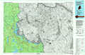 |
Dover-Foxcroft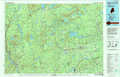 |
Lincoln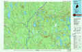 |
Calais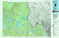 |
> Back to 45068a1 at 1:250,000 scale
> Back to U.S. Topo Maps home
1:24,000 Topo Quads covered by the spatial extent of this 100k map (Millinocket)
|
Mount Katahdin 
|
Katahdin Lake 
|
Deasey Mountain 
|
Lookout Mountain 
|
Patten 
|
Crystal 
|
Mattawamkeag Lake 
|
Monument Brook 
|
|
Abol Pond 
|
Trout Mountain 
|
Whetstone Mountain 
|
Stacyville 
|
Benedicta 
|
Monarda 
|
Wytopitlock Lake 
|
Alder Brook 
|
|
Pemadumcook Lake 
|
Norcross 
|
Millinocket 
|
East Millinocket 
|
Salmon Stream Lake 
|
Molunkid Lake 
|
Reed Pond 
|
Wytopitlock 
|
|
Ragged Mountain 
|
Cedar Lake 
|
Nollesemic Lake 
|
Medunkeunk Lake 
|
Mattaseunk Lake 
|
Mattawamkeag 
|
Kingman 
|
Potter Hill 
|
