Ekalaka Topo Map Montana
To zoom in, hover over the map of Ekalaka
USGS Topo Map 45104e1 - 1:100,000 scale
| Topo Map Name: | Ekalaka |
| USGS Topo Quad ID: | 45104e1 |
| Print Size: | ca. 39" wide x 24" high |
| Southeast Coordinates: | 45.5° N latitude / 104° W longitude |
| Map Center Coordinates: | 45.75° N latitude / 104.5° W longitude |
| U.S. States: | MT, SD, ND |
| Filename: | 45104e1.jpg |
| Download Map JPG Image: | Ekalaka topo map 1:100,000 scale |
| Map Type: | Topographic |
| Topo Series: | 30´x60´ |
| Map Scale: | 1:100,000 |
| Source of Map Images: | United States Geological Survey (USGS) |
| Alternate Map Versions: |
Ekalaka MT 1982, updated 1983 Download PDF Buy paper map |
1:100,000 Topos surrounding Ekalaka
Miles City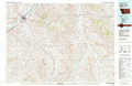 |
Baker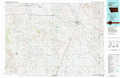 |
Bowman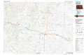 |
Powderville |
Ekalaka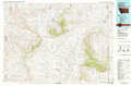 |
Camp Crook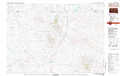 |
Broadus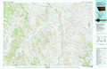 |
Alzada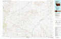 |
Redig |
> Back to 45104a1 at 1:250,000 scale
> Back to U.S. Topo Maps home
1:24,000 Topo Quads covered by the spatial extent of this 100k map (Ekalaka)
|
Blacktail Creek Nw 
|
Board Corral Creek 
|
Beaver Flats North 
|
Ekalaka 
|
Terrell Creek 
|
Dutchman Hill 
|
Flasted Hill 
|
Snider Hill 
|
|
Blacktail Creek Sw 
|
Blacktail Creek Se 
|
Beaver Flats South 
|
Stagville Draw 
|
Camp Needmore 
|
Lampkin Gulch 
|
Mill Iron 
|
Humbolt Hills 
|
|
Davis Creek West 
|
Davis Creek East 
|
Chalk Buttes 
|
Dead Boy Divide 
|
Taylor Hills 
|
Belltower 
|
Rustler Divide 
|
North Slick Creek 
|
|
Pocochichee Butte 
|
W L Butte 
|
Dutchman Creek 
|
Ikey Creek 
|
School Section Creek 
|
Belltower Butte 
|
Timber Hill 
|
Capitol Rock 
|
