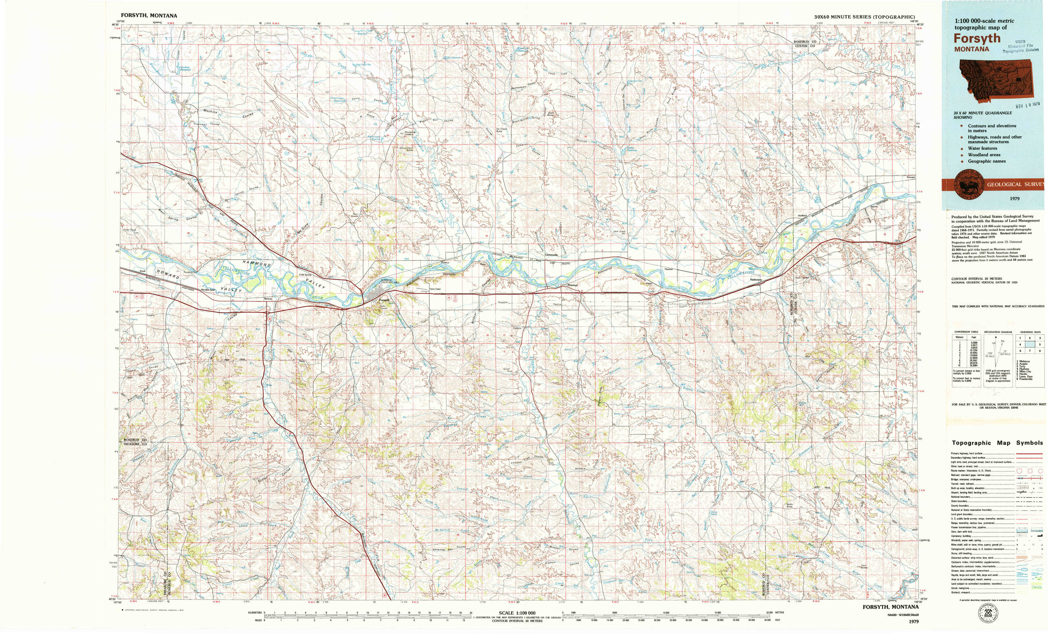
Forsyth Topo Map Montana
To zoom in, hover over the map of Forsyth
USGS Topo Map 46106a1 - 1:100,000 scale
| Topo Map Name: | Forsyth |
| USGS Topo Quad ID: | 46106a1 |
| Print Size: | ca. 39" wide x 24" high |
| Southeast Coordinates: | 46° N latitude / 106° W longitude |
| Map Center Coordinates: | 46.25° N latitude / 106.5° W longitude |
| U.S. State: | MT |
| Filename: | 46106a1.jpg |
| Download Map JPG Image: | Forsyth topo map 1:100,000 scale |
| Map Type: | Topographic |
| Topo Series: | 30´x60´ |
| Map Scale: | 1:100,000 |
| Source of Map Images: | United States Geological Survey (USGS) |
| Alternate Map Versions: |
Forsyth MT 1979, updated 1979 Download PDF Buy paper map |
1:100,000 Topos surrounding Forsyth
Melstone |
Angela |
Terry |
Hysham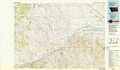 |
Forsyth |
Miles City |
Hardin |
Lame Deer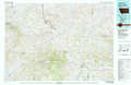 |
Powderville |
> Back to 46106a1 at 1:250,000 scale
> Back to U.S. Topo Maps home
1:24,000 Topo Quads covered by the spatial extent of this 100k map (Forsyth)
|
Donleys Reservoir 
|
Finch Ne 
|
Black Coulee 
|
Schultz Coulee 
|
Box Canyon Coulee 
|
Sand Buttes 
|
Hathaway Nw 
|
Butterfly Creek 
|
|
Finch 
|
Nichols 
|
Forsyth 
|
Orinoco 
|
Rosebud 
|
Thurlow 
|
Hathaway 
|
Horton 
|
|
Griffin Coulee Nw 
|
Griffin Coulee Ne 
|
Smith Creek 
|
Smith Creek Ne 
|
Rosebud Buttes 
|
Indian Creek 
|
Miller Creek Nw 
|
Moon Creek School 
|
|
Griffin Coulee Sw 
|
Griffin Coulee 
|
Sheep Creek Camp 
|
Mckerlich Creek 
|
Mitchell Coulee 
|
Crain Place 
|
Miller Creek Sw 
|
Miller Creek 
|