Pullman Topo Map Washington
To zoom in, hover over the map of Pullman
USGS Topo Map 46117e1 - 1:100,000 scale
| Topo Map Name: | Pullman |
| USGS Topo Quad ID: | 46117e1 |
| Print Size: | ca. 39" wide x 24" high |
| Southeast Coordinates: | 46.5° N latitude / 117° W longitude |
| Map Center Coordinates: | 46.75° N latitude / 117.5° W longitude |
| U.S. States: | WA, ID |
| Filename: | 46117e1.jpg |
| Download Map JPG Image: | Pullman topo map 1:100,000 scale |
| Map Type: | Topographic |
| Topo Series: | 30´x60´ |
| Map Scale: | 1:100,000 |
| Source of Map Images: | United States Geological Survey (USGS) |
| Alternate Map Versions: |
Pullman WA 1982, updated 1982 Download PDF Buy paper map |
1:100,000 Topos surrounding Pullman
Ritzville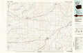 |
Rosalia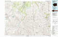 |
Saint Maries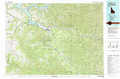 |
Connell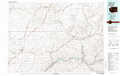 |
Pullman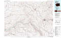 |
Potlatch |
Walla Walla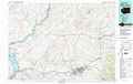 |
Clarkston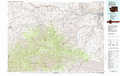 |
Orofino |
> Back to 46116a1 at 1:250,000 scale
> Back to U.S. Topo Maps home
1:24,000 Topo Quads covered by the spatial extent of this 100k map (Pullman)
|
Honn Lakes 
|
Winona 
|
Endicott 
|
Thera 
|
Diamond 
|
Colfax North 
|
Elberton 
|
Palouse 
|
|
La Crosse West 
|
La Crosse East 
|
Dusty 
|
Little Penawawa Creek 
|
Wilcox 
|
Colfax South 
|
Albion 
|
Viola 
|
|
Hay 
|
Central Ferry 
|
Ping 
|
Wades Bar 
|
Almota 
|
Ewartsville 
|
Pullman 
|
Moscow West 
|
|
Delaney 
|
Dodge 
|
Falling Springs 
|
Gould City 
|
Kirby 
|
Granite Point 
|
Colton 
|
Uniontown 
|
